Area Overview for TN15 8JQ
Photos of TN15 8JQ


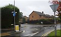
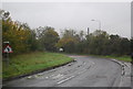
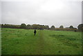

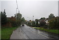
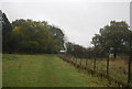

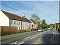


53 photos from this area
Area Information
Key information about the TN15 8JQ including its size, population, and administrative classification.
- Area Type
- Postcode
- Area Size
- 2.3 hectares
- Population
- 2096
- Population Density
- 297 people/km²
House Prices in TN15 8JQ
24
Properties
£396,567
Average Sold Price
£158,000
Lowest Price
£627,000
Highest Price
Showing 24 properties
| Address | Type | Beds | Baths | Last Sale Price | Last Sale Date | |
|---|---|---|---|---|---|---|
| 17 Minters Orchard, Platt, Sevenoaks, TN15 8JQ | house | 4 | - | £627,000 | Oct 2025 | |
| 33 Minters Orchard, Platt, Sevenoaks, TN15 8JQ | house | 4 | 2 | £565,000 | Dec 2024 | |
| 43 Minters Orchard, Platt, Sevenoaks, TN15 8JQ | Detached | 4 | 2 | £525,000 | May 2023 | |
| 21 Minters Orchard, Platt, Sevenoaks, TN15 8JQ | house | 4 | 2 | £500,000 | May 2022 | |
| 27 Minters Orchard, Platt, Sevenoaks, TN15 8JQ | Retail | 4 | 3 | £575,000 | Mar 2022 | |
| 29 Minters Orchard, Platt, Sevenoaks, TN15 8JQ | Detached | 4 | 2 | £565,000 | Sep 2021 | |
| 47 Minters Orchard, Platt, Sevenoaks, TN15 8JQ | Detached | 4 | 2 | £586,000 | Jun 2020 | |
| 41 Minters Orchard, Platt, Sevenoaks, TN15 8JQ | Detached | 4 | 2 | £200,000 | May 2018 | |
| 45 Minters Orchard, Platt, Sevenoaks, TN15 8JQ | Detached | 4 | 3 | £427,950 | Apr 2016 | |
| 15 Minters Orchard, Platt, Sevenoaks, TN15 8JQ | house | - | - | £400,000 | Feb 2016 |
Page 1 of 3
Energy Efficiency in TN15 8JQ
Amenities
Schools
| Rank | School | Type | Entry gender | Ages |
|---|
Explore more schools in this area
Go to Schools tabDemographics
Household Size
Two person
most common
Accommodation Type
Houses
most common
Tenure
86
majority
Ethnic Group
White
most common
Religion
N/A
most common
Household Composition
N/A
most common
Age
47
median
Adults (30-64 years)
most common
Household Deprivation
N/A
with no deprivation
NS-SEC
49
in Lower managerial occupations
Explore more demographic insights in this area
Go to Demographics tabPlanning
Planning Constraints
- Flood RiskPremium
- Ramsar Wetland SitesPremium
- Area of Outstanding Natural BeautyPremium
- Protected Nature ReservePremium
- Protected WoodlandPremium