Area Overview for TN15 8JH
Photos of TN15 8JH

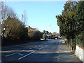
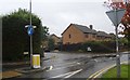
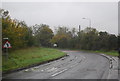
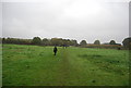
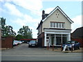
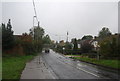
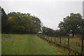
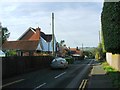
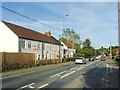
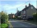
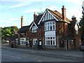
53 photos from this area
Area Information
Key information about the TN15 8JH including its size, population, and administrative classification.
- Area Type
- Postcode
- Area Size
- 3.3 hectares
- Population
- 2096
- Population Density
- 297 people/km²
House Prices in TN15 8JH
9
Properties
£721,075
Average Sold Price
£330,000
Lowest Price
£1,200,375
Highest Price
Showing 9 properties
| Address | Type | Beds | Baths | Last Sale Price | Last Sale Date | |
|---|---|---|---|---|---|---|
| Staddleswood, Maidstone Road, Platt, Sevenoaks, TN15 8JH | Detached | 5 | 4 | £1,200,375 | Jul 2022 | |
| The Hideaway, Maidstone Road, Platt, Sevenoaks, TN15 8JH | Detached | 5 | 2 | £715,000 | Jul 2018 | |
| Rowan Wood, Maidstone Road, Platt, Sevenoaks, TN15 8JH | Bungalow | 3 | 2 | £670,000 | Mar 2014 | |
| Stone House Villa, Maidstone Road, Platt, Sevenoaks, TN15 8JH | Semi-detached | - | - | £330,000 | Jul 2006 | |
| Bracken Hill, Maidstone Road, Platt, Sevenoaks, TN15 8JH | Detached | - | - | £690,000 | Oct 2002 | |
| 1 Fir Tree Cottages, Maidstone Road, Platt, Sevenoaks, TN15 8JH | Semi-detached | 2 | 1 | - | - | |
| Tanglin, Maidstone Road, Platt, Sevenoaks, TN15 8JH | Detached | - | - | - | - | |
| Stone Cottage, Maidstone Road, Platt, Sevenoaks, TN15 8JH | Bungalow | 1 | - | - | - | |
| 2 Fir Tree Cottages, Maidstone Road, Platt, Sevenoaks, TN15 8JH | Semi-detached | - | - | - | - |
Energy Efficiency in TN15 8JH
Amenities
Schools
| Rank | School | Type | Entry gender | Ages |
|---|
Explore more schools in this area
Go to Schools tabDemographics
Household Size
Two person
most common
Accommodation Type
Houses
most common
Tenure
86
majority
Ethnic Group
White
most common
Religion
N/A
most common
Household Composition
N/A
most common
Age
47
median
Adults (30-64 years)
most common
Household Deprivation
N/A
with no deprivation
NS-SEC
49
in Lower managerial occupations
Explore more demographic insights in this area
Go to Demographics tabPlanning
Planning Constraints
- Flood RiskPremium
- Ramsar Wetland SitesPremium
- Area of Outstanding Natural BeautyPremium
- Protected Nature ReservePremium
- Protected WoodlandPremium