Area Overview for TN15 8HE
Photos of TN15 8HE


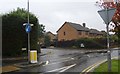
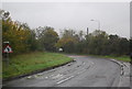
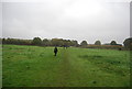

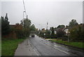


53 photos from this area
Area Information
Key information about the TN15 8HE including its size, population, and administrative classification.
- Area Type
- Postcode
- Area Size
- 2.3 hectares
- Population
- 1886
- Population Density
- 2189 people/km²
House Prices in TN15 8HE
40
Properties
£296,173
Average Sold Price
£46,500
Lowest Price
£657,000
Highest Price
Showing 40 properties
| Address | Type | Beds | Baths | Last Sale Price | Last Sale Date | |
|---|---|---|---|---|---|---|
| 73 Maidstone Road, Borough Green, Sevenoaks, TN15 8HE | Detached | 2 | 1 | £340,000 | Aug 2025 | |
| 151 Maidstone Road, Borough Green, Sevenoaks, TN15 8HE | Detached | 4 | 1 | £585,000 | Jan 2024 | |
| 51 Maidstone Road, Borough Green, Sevenoaks, TN15 8HE | Bungalow | 3 | 1 | £446,000 | Oct 2023 | |
| Rhoslan, 103 Maidstone Road, Borough Green, Sevenoaks, TN15 8HE | Terraced | 5 | 3 | £355,000 | Feb 2021 | |
| 129 Maidstone Road, Borough Green, Sevenoaks, TN15 8HE | Detached | 5 | 3 | £657,000 | Nov 2018 | |
| 113 Maidstone Road, Borough Green, Sevenoaks, TN15 8HE | Bungalow | - | - | £400,000 | Feb 2017 | |
| 127 Maidstone Road, Borough Green, Sevenoaks, TN15 8HE | house | - | - | £430,000 | Aug 2016 | |
| 101 Maidstone Road, Borough Green, Sevenoaks, TN15 8HE | Semi-detached | 2 | 1 | £245,000 | Mar 2015 | |
| 109 Maidstone Road, Borough Green, Sevenoaks, TN15 8HE | Semi-detached | - | - | £249,995 | Jan 2007 | |
| 121 Maidstone Road, Borough Green, Sevenoaks, TN15 8HE | house | 3 | - | £225,000 | Sep 2004 |
Page 1 of 4
Energy Efficiency in TN15 8HE
Amenities
Schools
| Rank | School | Type | Entry gender | Ages |
|---|
Explore more schools in this area
Go to Schools tabDemographics
Household Size
Family (3-5 people)
most common
Accommodation Type
Houses
most common
Tenure
66
majority
Ethnic Group
White
most common
Religion
N/A
most common
Household Composition
N/A
most common
Age
47
median
Adults (30-64 years)
most common
Household Deprivation
N/A
with no deprivation
NS-SEC
33
in Lower managerial occupations
Explore more demographic insights in this area
Go to Demographics tabPlanning
Planning Constraints
- Flood RiskPremium
- Ramsar Wetland SitesPremium
- Area of Outstanding Natural BeautyPremium
- Protected Nature ReservePremium
- Protected WoodlandPremium