Area Overview for TN15 6FA
Photos of TN15 6FA
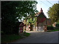
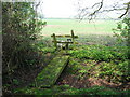
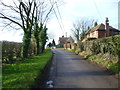
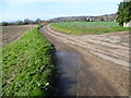
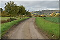
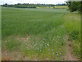

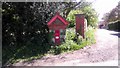
25 photos from this area
Area Information
Key information about the TN15 6FA including its size, population, and administrative classification.
- Area Type
- Postcode
- Area Size
- 17.6 hectares
- Population
- 1961
- Population Density
- 142 people/km²
House Prices in TN15 6FA
14
Properties
£900,000
Average Sold Price
£900,000
Lowest Price
£900,000
Highest Price
Showing 14 properties
| Address | Type | Beds | Baths | Last Sale Price | Last Sale Date | |
|---|---|---|---|---|---|---|
| The Lodge, 2 Yaldham Manor Drive, Kemsing, Sevenoaks, TN15 6FA | house | - | - | £900,000 | Nov 2016 | |
| The Becket, 3 Yaldham Manor Drive, Kemsing, Sevenoaks, TN15 6FA | Detached | 4 | 3 | - | - | |
| Woodmans Cottage, 1 Yaldham Manor Drive, Kemsing, Sevenoaks, TN15 6FA | Detached | 5 | 4 | - | - | |
| Long Barn, 8 Yaldham Manor Drive, Kemsing, Sevenoaks, TN15 6FA | Bungalow | 3 | 3 | - | - | |
| The Possett, Yaldham Manor, Kemsing Road, Kemsing, Sevenoaks, TN15 6FA | Terraced | - | - | - | - | |
| The Oast, 11 Yaldham Manor Drive, Kemsing, Sevenoaks, TN15 6FA | Detached | 3 | - | - | - | |
| The Granary, 9 Yaldham Manor Drive, Kemsing, Sevenoaks, TN15 6FA | Detached | - | - | - | - | |
| Rosemary Cottage, Yaldham Manor, Kemsing Road, Kemsing, Sevenoaks, TN15 6FA | undefined | - | - | - | - | |
| Barn North Of, Kemsing Road, Kemsing, Sevenoaks, TN15 6FA | Farm | - | - | - | - | |
| Regia House, 5 Yaldham Manor Drive, Kemsing, Sevenoaks, TN15 6FA | house | - | - | - | - |
Page 1 of 2
Energy Efficiency in TN15 6FA
Amenities
Schools
| Rank | School | Type | Entry gender | Ages |
|---|
Explore more schools in this area
Go to Schools tabDemographics
Household Size
Family (3-5 people)
most common
Accommodation Type
Houses
most common
Tenure
70
majority
Ethnic Group
White
most common
Religion
N/A
most common
Household Composition
N/A
most common
Age
47
median
Adults (30-64 years)
most common
Household Deprivation
N/A
with no deprivation
NS-SEC
38
in Lower managerial occupations
Explore more demographic insights in this area
Go to Demographics tabPlanning
Planning Constraints
- Flood RiskPremium
- Ramsar Wetland SitesPremium
- Area of Outstanding Natural BeautyPremium
- Protected Nature ReservePremium
- Protected WoodlandPremium