Area Overview for TN15 0ES
Photos of TN15 0ES

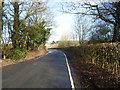
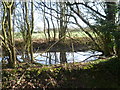
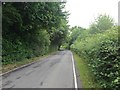
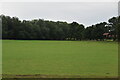
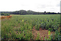
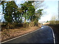
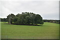
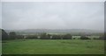
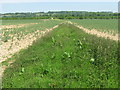
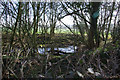
11 photos from this area
Area Information
Key information about the TN15 0ES including its size, population, and administrative classification.
- Area Type
- Postcode
- Area Size
- 1.8 km²
- Population
- 1415
- Population Density
- 113 people/km²
House Prices in TN15 0ES
31
Properties
£1,400,268
Average Sold Price
£278,000
Lowest Price
£6,000,000
Highest Price
Showing 31 properties
| Address | Type | Beds | Baths | Last Sale Price | Last Sale Date | |
|---|---|---|---|---|---|---|
| The Coach House, Pillar Box Lane, Seal Chart, TN15 0ES | house | - | - | £770,000 | Dec 2023 | |
| Broomsleigh Park, Styants Bottom Road, Seal, TN15 0ES | Detached | 8 | 4 | £6,000,000 | Apr 2021 | |
| Fiddlers Hill, Styants Bottom Road, Seal, TN15 0ES | house | - | - | £2,175,000 | Aug 2020 | |
| Highfield, Styants Bottom Road, Seal, TN15 0ES | Bungalow | 4 | - | £875,000 | Oct 2019 | |
| Little Chart, Styants Bottom Road, Seal, TN15 0ES | Bungalow | - | - | £560,000 | Apr 2019 | |
| Chart Oast, Styants Bottom Road, Seal, TN15 0ES | Detached | 7 | 3 | £1,999,999 | Jun 2014 | |
| Bank Top Cottage, Styants Bottom Road, Seal, TN15 0ES | house | 4 | - | £1,175,000 | Jan 2013 | |
| Broomsleigh South Lodge, Styants Bottom Road, Seal, TN15 0ES | Detached | - | - | £590,000 | Feb 2002 | |
| Chart Corner Cottage, Styants Bottom Road, Seal, TN15 0ES | Detached | - | - | £499,950 | Nov 2001 | |
| Chart Farm House, Styants Bottom Road, Seal, TN15 0ES | house | 5 | - | £278,000 | Dec 1996 |
Page 1 of 4
Energy Efficiency in TN15 0ES
Amenities
Schools
| Rank | School | Type | Entry gender | Ages |
|---|
Explore more schools in this area
Go to Schools tabDemographics
Household Size
Family (3-5 people)
most common
Accommodation Type
Houses
most common
Tenure
83
majority
Ethnic Group
White
most common
Religion
N/A
most common
Household Composition
N/A
most common
Age
47
median
Adults (30-64 years)
most common
Household Deprivation
N/A
with no deprivation
NS-SEC
58
in Lower managerial occupations
Explore more demographic insights in this area
Go to Demographics tabPlanning
Planning Constraints
- Flood RiskPremium
- Ramsar Wetland SitesPremium
- Area of Outstanding Natural BeautyPremium
- Protected Nature ReservePremium
- Protected WoodlandPremium