Area Overview for TN15 0ET
Photos of TN15 0ET
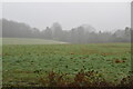
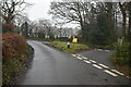
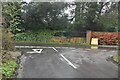
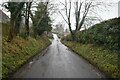
55 photos from this area
Area Information
Key information about the TN15 0ET including its size, population, and administrative classification.
- Area Type
- Postcode
- Area Size
- 25.4 hectares
- Population
- 2038
- Population Density
- 221 people/km²
House Prices in TN15 0ET
8
Properties
£535,500
Average Sold Price
£40,000
Lowest Price
£910,000
Highest Price
Showing 8 properties
| Address | Type | Beds | Baths | Last Sale Price | Last Sale Date | |
|---|---|---|---|---|---|---|
| Durrants, Styants Bottom Road, Seal Chart, Sevenoaks, TN15 0ET | Detached | 5 | - | £910,000 | Aug 2018 | |
| Styants Farmhouse, Styants Bottom Road, Seal Chart, Sevenoaks, TN15 0ET | house | - | - | £615,000 | Dec 2016 | |
| Barnmead, Styants Bottom Road, Seal Chart, Sevenoaks, TN15 0ET | Detached | - | - | £577,000 | Nov 2006 | |
| Styants Farm Barn, Styants Bottom Road, Seal Chart, Sevenoaks, TN15 0ET | Semi-detached | 3 | - | £40,000 | Oct 1995 | |
| Styants Oast House, Styants Bottom Road, Seal Chart, Sevenoaks, TN15 0ET | Semi-detached | 4 | 3 | - | - | |
| The Old Cottage, Styants Bottom Road, Seal Chart, Sevenoaks, TN15 0ET | Detached | - | - | - | - | |
| The Camping And Caravaning Club, Camping And Caravan Club, Styants Bottom Road, Seal Chart, Sevenoaks, TN15 0ET | commercial | - | - | - | - | |
| Styants Cottage, Styants Bottom Road, Seal Chart, Sevenoaks, TN15 0ET | Detached | - | - | - | - |
Energy Efficiency in TN15 0ET
Amenities
Schools
| Rank | School | Type | Entry gender | Ages |
|---|
Explore more schools in this area
Go to Schools tabDemographics
Household Size
Family (3-5 people)
most common
Accommodation Type
Houses
most common
Tenure
89
majority
Ethnic Group
White
most common
Religion
N/A
most common
Household Composition
N/A
most common
Age
47
median
Adults (30-64 years)
most common
Household Deprivation
N/A
with no deprivation
NS-SEC
53
in Lower managerial occupations
Explore more demographic insights in this area
Go to Demographics tabPlanning
Planning Constraints
- Flood RiskPremium
- Ramsar Wetland SitesPremium
- Area of Outstanding Natural BeautyPremium
- Protected Nature ReservePremium
- Protected WoodlandPremium