Area Overview for TN14 7ND
Photos of TN14 7ND
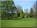
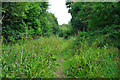
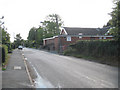
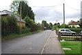
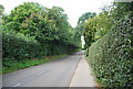
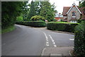
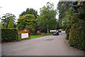
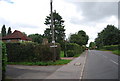
67 photos from this area
Area Information
Key information about the TN14 7ND including its size, population, and administrative classification.
- Area Type
- Postcode
- Area Size
- 9.0 hectares
- Population
- 1933
- Population Density
- 187 people/km²
House Prices in TN14 7ND
20
Properties
£492,278
Average Sold Price
£85,000
Lowest Price
£958,000
Highest Price
Showing 20 properties
| Address | Type | Beds | Baths | Last Sale Price | Last Sale Date | |
|---|---|---|---|---|---|---|
| Oaklands, Pound Lane, Knockholt, TN14 7ND | Detached | 4 | 2 | £958,000 | Aug 2023 | |
| Harlyn, Pound Lane, Knockholt, TN14 7ND | Bungalow | 1 | 1 | £550,000 | Jan 2017 | |
| Weald Cottage, Pound Lane, Knockholt, TN14 7ND | Detached | 5 | 2 | £755,000 | Sep 2016 | |
| Orchard End, Pound Lane, Knockholt, TN14 7ND | house | 4 | - | £655,000 | Dec 2013 | |
| Inukshuk, Pound Lane, Knockholt, TN14 7ND | house | - | - | £592,500 | Aug 2009 | |
| Philbec, Pound Lane, Knockholt, TN14 7ND | house | 7 | 4 | £300,000 | Oct 2007 | |
| Westmount, Pound Lane, Knockholt, TN14 7ND | house | - | - | £225,000 | Mar 2006 | |
| White Cottage, Pound Lane, Knockholt, TN14 7ND | Semi-detached | - | - | £310,000 | Jul 2001 | |
| Beverley, Pound Lane, Knockholt, TN14 7ND | house | 3 | - | £85,000 | Apr 1997 | |
| Mobile Home At Philbec, Pound Lane, Knockholt, TN14 7ND | Mobile Home | - | - | - | - |
Page 1 of 2
Energy Efficiency in TN14 7ND
Amenities
Schools
| Rank | School | Type | Entry gender | Ages |
|---|
Explore more schools in this area
Go to Schools tabDemographics
Household Size
Family (3-5 people)
most common
Accommodation Type
Houses
most common
Tenure
86
majority
Ethnic Group
White
most common
Religion
N/A
most common
Household Composition
N/A
most common
Age
47
median
Adults (30-64 years)
most common
Household Deprivation
N/A
with no deprivation
NS-SEC
44
in Lower managerial occupations
Explore more demographic insights in this area
Go to Demographics tabPlanning
Planning Constraints
- Flood RiskPremium
- Ramsar Wetland SitesPremium
- Area of Outstanding Natural BeautyPremium
- Protected Nature ReservePremium
- Protected WoodlandPremium