Area Overview for TN12 7LR
Photos of TN12 7LR

Area Information
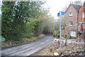
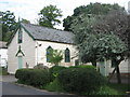
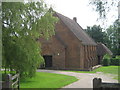
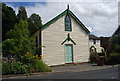
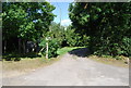
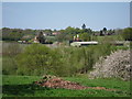
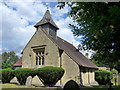
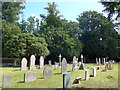
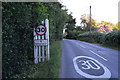
TN12 7LR is a small, residential postcode area nestled in the rural parish of Brenchley and Matfield, Kent. Covering 12.8 hectares, it is home to 1,733 residents, creating a tight-knit community with a low population density of 167 people per square kilometre. The area lies off the A21, near the B2162 road, just 3 miles south of Paddock Wood and 8 miles east of Royal Tunbridge Wells. Its character is defined by historic woodlands, medieval routeways, and conservation areas, with villages like Brenchley and Matfield surrounded by countryside. The parish includes hamlets such as Castle Hill and Petteridge, and its landscape is marked by an **Area of Outstanding Natural Beauty**. Daily life here is shaped by rural tranquillity, with historic sites like All Saints Church and Old Palace adding to its heritage. Residents benefit from proximity to nearby towns, while the area’s low population density ensures a peaceful, community-focused environment.
- Area Type
- Postcode
- Area Size
- 12.8 hectares
- Population
- 1733
- Population Density
- 167 people/km²
TN12 7LR is primarily an owner-occupied area, with 76% of homes owned by their residents. The accommodation type is predominantly houses, which is typical for a rural or semi-rural postcode. This suggests a housing stock suited to families or individuals seeking space and privacy. The small area size of 12.8 hectares implies limited housing density, meaning properties are likely spread out, possibly in larger gardens or plots. For buyers, this could mean a focus on individual homes rather than apartments or terraced housing. The proximity to nearby towns like Paddock Wood and Royal Tunbridge Wells may influence property values, offering a balance between rural living and access to urban amenities. However, the small size of the area means the immediate surroundings are crucial for assessing housing options.
House Prices in TN12 7LR
Showing 44 properties
| Address | Type | Beds | Baths | Last Sale Price | Last Sale Date | |
|---|---|---|---|---|---|---|
| 9, Porters Wood, Petteridge Lane, Matfield, Tonbridge, TN12 7LR | Semi-detached | 2 | 1 | £400,000 | Sep 2024 | |
| 21, Porters Wood, Petteridge Lane, Matfield, Tonbridge, TN12 7LR | house | - | - | £292,250 | Apr 2023 | |
| 29, Porters Wood, Petteridge Lane, Matfield, Tonbridge, TN12 7LR | house | 3 | 2 | £250,000 | Apr 2023 | |
| 16, Porters Wood, Petteridge Lane, Matfield, Tonbridge, TN12 7LR | Detached | 2 | 1 | £337,000 | Mar 2023 | |
| 15, Porters Wood, Petteridge Lane, Matfield, Tonbridge, TN12 7LR | Semi-detached | 2 | 1 | £340,000 | Aug 2022 | |
| 14, Porters Wood, Petteridge Lane, Matfield, Tonbridge, TN12 7LR | house | 3 | 1 | £360,000 | Aug 2022 | |
| 13, Porters Wood, Petteridge Lane, Matfield, Tonbridge, TN12 7LR | Terraced | 3 | - | £335,000 | Apr 2021 | |
| 1, Porters Wood, Petteridge Lane, Matfield, Tonbridge, TN12 7LR | Semi-detached | 3 | 1 | £302,000 | May 2015 | |
| 39, Porters Wood, Petteridge Lane, Matfield, Tonbridge, TN12 7LR | Semi-detached | 3 | 1 | £340,000 | Aug 2014 | |
| 36, Porters Wood, Petteridge Lane, Matfield, Tonbridge, TN12 7LR | Semi-detached | 3 | - | £240,000 | Oct 2013 |
Energy Efficiency in TN12 7LR
The lifestyle in TN12 7LR is shaped by its rural setting and proximity to nearby towns. Retail options include **M&S Blue Boys Tonbridge BP**, **Tesco Paddock**, and **Waitrose Paddock**, providing access to everyday shopping. The area’s character is enhanced by historic sites like All Saints Church and the **Old Palace**, which reflect its medieval heritage. Residents can enjoy countryside walks and the natural beauty of the surrounding **Area of Outstanding Natural Beauty**. The presence of rail stations and a metro link ensures convenience for those needing to travel further afield. While the immediate area has limited leisure facilities, the nearby towns of Paddock Wood and Royal Tunbridge Wells offer additional dining, entertainment, and cultural opportunities.
Amenities
Schools
The area is served by two primary schools: **Brenchley and Matfield Church of England Voluntary Aided Primary School** and **Brenchley and Matfield Church of England Primary School**. Both are primary schools, though specific Ofsted ratings are not provided in the data. The presence of two primary schools suggests a focus on early education, potentially catering to local families with young children. The duplication of names may indicate a single school with multiple campuses or a shared governance structure. For families, this provides options for schooling, though the lack of secondary schools in the immediate area may require commuting to nearby towns. The schools’ religious affiliation aligns with the parish’s historical ties to the Church of England.
| Rank | School | Type | Entry gender | Ages |
|---|
Explore more schools in this area
Go to Schools tabDemographics
The population of TN12 7LR has a median age of 47, with the majority of residents aged between 30 and 64 years. This suggests a mature, stable community, likely composed of families and long-term residents. Home ownership is high at 76%, indicating a strong preference for owning property over renting. The accommodation type is predominantly houses, reflecting a suburban or semi-rural housing stock. The predominant ethnic group is White, which aligns with the broader demographic profile of the region. The absence of specific deprivation data means the area’s quality of life is inferred from its low population density, historical stability, and access to amenities. With a population of 1,733, the community is small enough to foster familiarity but large enough to support essential services.
Household Size
Accommodation Type
Tenure
Ethnic Group
Religion
Household Composition
Age
Household Deprivation
NS-SEC
Explore more demographic insights in this area
Go to Demographics tabPlanning
Planning Constraints
- Flood RiskPremium
- Ramsar Wetland SitesPremium
- Area of Outstanding Natural BeautyPremium
- Protected Nature ReservePremium
- Protected WoodlandPremium