Area Overview for TN12 7EJ
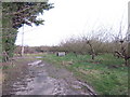
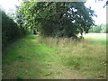
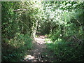
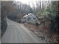
Photos of TN12 7EJ
Area Information
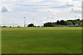
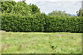
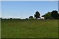
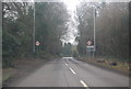
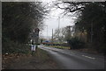
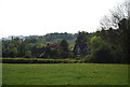
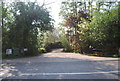
TN12 7EJ is a small, residential postcode area nestled in the rural parish of Brenchley and Matfield, part of the Borough of Tunbridge Wells in Kent. Covering 24.7 hectares, it is home to 1,733 people, resulting in a population density of 167 people per square kilometre. The area is characterised by its proximity to natural landscapes and historic sites, with the A21 and B2162 roads providing access to nearby towns such as Paddock Wood and Royal Tunbridge Wells. This postcode cluster lies within a region noted for its conservation areas and medieval heritage, including All Saints Church and the Old Palace. Daily life here is shaped by a close-knit community, with a mix of traditional village centres and modern field layouts. The area’s low population density suggests a quieter, more rural lifestyle, ideal for those seeking tranquillity away from urban centres. With its blend of historical significance and accessible transport links, TN12 7EJ offers a distinctive balance of heritage and practicality for residents.
- Area Type
- Postcode
- Area Size
- 24.7 hectares
- Population
- 1733
- Population Density
- 167 people/km²
The property market in TN12 7EJ is dominated by owner-occupied homes, with 76% of properties owned outright. This high home ownership rate indicates a community of long-term residents and a limited rental market, which may make finding available properties challenging for buyers. The accommodation type is primarily houses, reflecting a preference for larger, private homes rather than flats or apartments. This suggests a market suited to families or individuals seeking space and independence. Given the small size of the area, the housing stock is likely limited, meaning buyers may need to consider nearby postcode areas for more options. The focus on houses also implies a market with a strong emphasis on traditional, standalone properties, which may appeal to those prioritising privacy and outdoor space.
House Prices in TN12 7EJ
Showing 4 properties
| Address | Type | Beds | Baths | Last Sale Price | Last Sale Date | |
|---|---|---|---|---|---|---|
| The Oast, Crittenden Road, Matfield, Tonbridge, TN12 7EJ | Detached | - | - | £480,000 | Jun 1999 | |
| Gedges Farm, Crittenden Road, Matfield, Tonbridge, TN12 7EJ | Detached | 4 | 4 | - | - | |
| The Coach House, Gedges Farm, Crittenden Road, Matfield, Tonbridge, TN12 7EJ | house | 4 | 4 | - | - | |
| Beech Tree Bungalow, Crittenden Road, Matfield, Tonbridge, TN12 7EJ | Bungalow | - | - | - | - |
Energy Efficiency in TN12 7EJ
Living in TN12 7EJ offers a blend of rural tranquillity and practical amenities. Nearby retail options include Tesco Paddock, Waitrose Paddock, and M&S Blue Boys Tonbridge BP, providing essential shopping and dining choices. The area’s rail stations, such as Paddock Wood and Beltring, offer easy access to larger towns, while the Tunbridge Wells West metro station connects to broader transport networks. The surrounding countryside and historic sites, including All Saints Church and the Old Palace, add cultural and recreational value. This mix of amenities supports a lifestyle that combines convenience with the charm of a smaller, historic community.
Amenities
Schools
The nearest schools to TN12 7EJ are Brenchley and Matfield Church of England Voluntary Aided Primary School and Brenchley and Matfield Church of England Primary School, both of which are primary institutions. While no Ofsted ratings are provided, the presence of two primary schools suggests a strong local education infrastructure for younger children. Families with children may benefit from the proximity of these schools, which are likely to serve the needs of the area’s population. However, the absence of secondary schools in the data means that parents may need to look further afield for secondary education. The availability of two primary schools could also indicate a community with a focus on early education, supporting families with young children.
| Rank | School | Type | Entry gender | Ages |
|---|
Explore more schools in this area
Go to Schools tabDemographics
The community in TN12 7EJ is predominantly composed of adults aged 30–64, with a median age of 47. This suggests a mature, stable population, likely with established careers and family ties. Home ownership is high, at 76%, indicating a strong presence of long-term residents and a lower rental market. The accommodation type is primarily houses, reflecting a preference for private, standalone properties over flats or apartments. The predominant ethnic group is White, with no data provided on other demographics. The population density of 167 people per square kilometre implies a low-pressure environment, conducive to a slower pace of life. While no specific deprivation data is available, the high home ownership and age profile suggest a community with relatively stable economic conditions. This demographic profile aligns with a lifestyle prioritising privacy, space, and proximity to natural surroundings.
Household Size
Accommodation Type
Tenure
Ethnic Group
Religion
Household Composition
Age
Household Deprivation
NS-SEC
Explore more demographic insights in this area
Go to Demographics tabPlanning
Planning Constraints
- Flood RiskPremium
- Ramsar Wetland SitesPremium
- Area of Outstanding Natural BeautyPremium
- Protected Nature ReservePremium
- Protected WoodlandPremium