Area Overview for TN12 7EA
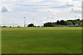
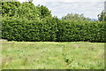
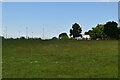
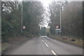
Photos of TN12 7EA
Area Information
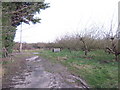
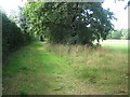
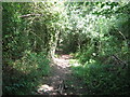
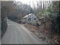
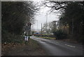
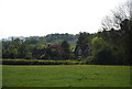
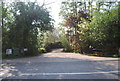
TN12 7EA is a small, tightly knit residential cluster nestled in the rural parish of Brenchley and Matfield, within the Borough of Tunbridge Wells, Kent. Covering 64.8 hectares, this area is home to 1,733 residents, offering a quiet, low-density living experience with a population density of 167 people per square kilometre. Positioned just 3 miles south of Paddock Wood and 8 miles east of Royal Tunbridge Wells, it sits off the A21 via the B2162, blending rural charm with practical connectivity. The area’s character is defined by its historic roots, including medieval woodlands and 14th-century buildings like the Old Vicarage, alongside modern field amalgamations. Daily life here is shaped by proximity to two primary schools, nearby rail stations, and a network of local shops. With a median age of 47 and a community skewed toward adults aged 30–64, TN12 7EA is a mature, stable neighbourhood where home ownership is high, and the pace of life remains unhurried.
- Area Type
- Postcode
- Area Size
- 64.8 hectares
- Population
- 1733
- Population Density
- 167 people/km²
TN12 7EA is predominantly an owner-occupied area, with 76% of residents living in homes they own. The housing stock is dominated by houses rather than flats or apartments, reflecting a preference for family-friendly, spacious properties. This makes the area particularly appealing to buyers seeking long-term stability and a connection to the surrounding countryside. However, the small size of the postcode area means the housing market is limited, with few properties available. Buyers may need to consider nearby villages or the broader Tunbridge Wells region for more options. The high home ownership rate also suggests strong local demand, which could influence property values. For those prioritising proximity to nature and low crime rates, TN12 7EA offers a compelling blend of security and rural tranquillity.
House Prices in TN12 7EA
Showing 16 properties
| Address | Type | Beds | Baths | Last Sale Price | Last Sale Date | |
|---|---|---|---|---|---|---|
| The Coach House, Gedges Hill, Matfield, Tonbridge, TN12 7EA | house | - | - | £1,180,000 | Feb 2023 | |
| Lymons Bank Barn, Gedges Hill, Matfield, Tonbridge, TN12 7EA | house | - | - | £300,000 | Sep 2016 | |
| Crundalls Bungalow, Gedges Hill, Matfield, Tonbridge, TN12 7EA | Bungalow | 2 | 3 | £432,500 | Sep 2015 | |
| Rose Cottage, Gedges Hill, Matfield, Tonbridge, TN12 7EA | Bungalow | - | - | £210,000 | Aug 2012 | |
| Gedges Lodge, Gedges Hill, Matfield, Tonbridge, TN12 7EA | Detached | 5 | 2 | £410,000 | Jan 2003 | |
| Crundalls Farmhouse, Gedges Hill, Matfield, Tonbridge, TN12 7EA | Detached | - | - | £160,000 | Dec 1995 | |
| White Barn Cottage, Gedges Hill, Matfield, Tonbridge, TN12 7EA | Detached | 4 | 2 | - | - | |
| Garage Flat At, Lymons Bank Farm, Gedges Hill, Matfield, Tonbridge, TN12 7EA | Detached | 6 | 2 | - | - | |
| Lymons Bank, Gedges Hill, Matfield, Tonbridge, TN12 7EA | Detached | 6 | - | - | - | |
| Weald Marketing Ltd, Unit 4, Crundalls Farm, Gedges Hill, Matfield, Tonbridge, TN12 7EA | Office | - | - | - | - |
Energy Efficiency in TN12 7EA
Living in TN12 7EA offers a blend of rural tranquillity and practical amenities. Within reach are retail options such as Tesco Paddock, Waitrose Paddock, and M&S Blue Boys Tonbridge BP, providing essential shopping and dining choices. The area’s proximity to the B2162 and A21 ensures easy access to nearby towns, while the nearby railway stations connect residents to broader networks. The parish’s designation as part of an Area of Outstanding Natural Beauty means residents can enjoy scenic landscapes and historic sites like All Saints Church, a Grade 1 listed building. The presence of protected woodland adds to the area’s character, though it may influence planning restrictions. Overall, the lifestyle here is defined by convenience, natural beauty, and a strong sense of community.
Amenities
Schools
Residents of TN12 7EA have access to two primary schools: Brenchley and Matfield Church of England Voluntary Aided Primary School and Brenchley and Matfield Church of England Primary School. Both institutions cater to younger children, providing a localised education option for families. The presence of two primary schools within the area ensures that children have multiple choices for schooling, though no secondary schools are listed in the data. This focus on primary education aligns with the area’s demographic profile, where a significant proportion of the population falls within the 30–64 age range, many of whom are likely to have children in primary education. The schools’ church-affiliated status may also reflect the area’s historical and cultural ties to religious institutions.
| Rank | School | Type | Entry gender | Ages |
|---|
Explore more schools in this area
Go to Schools tabDemographics
The population of TN12 7EA is predominantly adults aged 30–64, with a median age of 47, reflecting a mature, established community. Home ownership rates are robust at 76%, indicating a strong presence of long-term residents and a focus on property as an investment. The area is characterised by houses as the primary accommodation type, suggesting a mix of family homes and larger properties. The predominant ethnic group is White, aligning with broader trends in the region. With a population density of 167 people per square kilometre, the area avoids overcrowding, offering a balance between seclusion and accessibility. This demographic profile supports a stable, low-deprivation environment, where residents are likely to prioritise community ties, local amenities, and the preservation of rural character.
Household Size
Accommodation Type
Tenure
Ethnic Group
Religion
Household Composition
Age
Household Deprivation
NS-SEC
Explore more demographic insights in this area
Go to Demographics tabPlanning
Planning Constraints
- Flood RiskPremium
- Ramsar Wetland SitesPremium
- Area of Outstanding Natural BeautyPremium
- Protected Nature ReservePremium
- Protected WoodlandPremium