Area Overview for Spelthorne District (B)
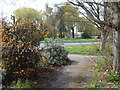
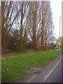
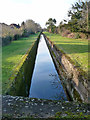
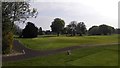
Photos of Spelthorne District (B)


Area Information
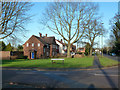
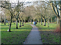
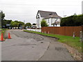
Spelthorne District (B) covers an area of 51.2 square kilometres, offering a compact yet varied living environment within Surrey, England. You will find that this local authority district has evolved into a community with a distinct character, where daily life is shaped by a significant proportion of older residents. Unlike many neighbouring London suburbs, this area reflects a different demographic rhythm. The district serves as a practical choice for buyers seeking a specific type of settlement rather than standard commuter convenience. The landscape here includes residential zones that support a population with a notable median age of 70 years. This statistic defines the social fabric more than any other demographic marker. Living in Spelthorne District (B) means engaging with a neighbourhood where retirement and later life stages are more prominent. The local infrastructure and services adapt to these needs, creating a self-contained community feel. The area size allows for low-density living in certain parts while maintaining access to essential amenities. You do not struggle here with the congestion typical of larger metropolitan districts. Instead, the compact footprint of 51.2 km² means distances between key locations remain manageable. This district stands apart from generic borough profiles due to its specific age profile and manageable scale.
- Area Type
- District/Borough
- Area Size
- 51.2 km²
- Population
- Not available
- Population Density
- Not available
Demographics
The community in Spelthorne District (B) is defined by a very mature population structure. You will find that the median age for residents sits at 70 years, making this a statistically older area than the national average. The most common age range data indicates a concentration of people in the Total category, reflecting the broad spread but heavily weighted towards older demographics. This profile suggests you are moving into a quiet neighbourhood where social activities may centre around clubs, healthcare, and community halls rather than nightlife. Home ownership is the dominant living arrangement, with 69% of houses or flats occupied by their owners. This high rate implies low turnover and established residents who have put down roots for decades. You are unlikely here to encounter a transient population or a high volume of short-term rentals. The household composition supports this stability, pointing towards multi-generational families or individuals living alone in comfortable surroundings. Diversity figures are recorded as Total, indicating the presence of various ethnic groups alongside the predominant groups. Religion statistics are similarly recorded as Total, showing a mix of faiths and secular residents. While the specific breakdown percentages are not itemised, the Total classification confirms a recognised diversity within the district borders. You can expect a community that is set in its ways but remains culturally inclusive.
Household Size
Accommodation Type
Tenure
Ethnic Group
Religion
Household Composition
Age
Household Deprivation
NS-SEC
Explore more demographic insights in this area
Go to Demographics tabPlanning
Planning Constraints
- Flood RiskPremium
- Ramsar Wetland SitesPremium
- Area of Outstanding Natural BeautyPremium
- Protected Nature ReservePremium
- Crime RiskPremium