Area Overview for SP6 2QY
Photos of SP6 2QY
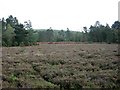
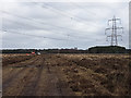
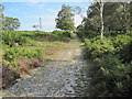
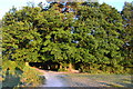
18 photos from this area
Area Information
Key information about the SP6 2QY including its size, population, and administrative classification.
- Area Type
- Postcode
- Area Size
- 1.9 km²
- Population
- 1305
- Population Density
- 38 people/km²
House Prices in SP6 2QY
10
Properties
£707,143
Average Sold Price
£163,000
Lowest Price
£1,205,000
Highest Price
Showing 10 properties
| Address | Type | Beds | Baths | Last Sale Price | Last Sale Date | |
|---|---|---|---|---|---|---|
| Hill Top, Warren Copse, Woodgreen, SP6 2QY | Bungalow | - | - | £980,000 | Dec 2020 | |
| Squirrels, Warren Copse, Woodgreen, SP6 2QY | Cottage | 2 | 1 | £450,000 | Jan 2018 | |
| Millersford Lodge, Warren Copse, Woodgreen, SP6 2QY | house | - | - | £1,205,000 | May 2017 | |
| Warren Close, Warren Copse, Woodgreen, SP6 2QY | house | 5 | - | £1,060,000 | May 2016 | |
| Brackens, Warren Copse, Woodgreen, SP6 2QY | Cottage | 5 | - | £850,000 | Aug 2011 | |
| Midsummer Wood, Warren Copse, Woodgreen, SP6 2QY | Detached | 4 | 3 | £242,000 | Jun 1999 | |
| Holly Lodge, Warren Copse, Woodgreen, SP6 2QY | Bungalow | 3 | - | £163,000 | Nov 1996 | |
| The Long House, Warren Copse, Woodgreen, SP6 2QY | Bungalow | - | - | - | - | |
| Annexe, Millersford Lodge, Warren Copse, Woodgreen, SP6 2QY | Flat | - | - | - | - | |
| Caravan Farringdon House, Land At, Warren Copse, Woodgreen, SP6 2QY | Mobile Home | - | - | - | - |
Energy Efficiency in SP6 2QY
Amenities
Schools
| Rank | School | Type | Entry gender | Ages |
|---|
Explore more schools in this area
Go to Schools tabDemographics
Household Size
Two person
most common
Accommodation Type
Houses
most common
Tenure
89
majority
Ethnic Group
White
most common
Religion
N/A
most common
Household Composition
N/A
most common
Age
47
median
Adults (30-64 years)
most common
Household Deprivation
N/A
with no deprivation
NS-SEC
44
in Lower managerial occupations
Explore more demographic insights in this area
Go to Demographics tabPlanning
Planning Constraints
- Flood RiskPremium
- Ramsar Wetland SitesPremium
- Area of Outstanding Natural BeautyPremium
- Protected Nature ReservePremium
- Protected WoodlandPremium