Area Overview for SP6 2NT
Photos of SP6 2NT
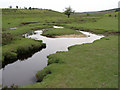
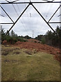
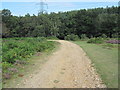
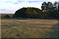
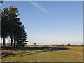
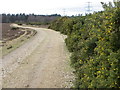
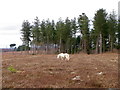
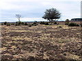
36 photos from this area
Area Information
Key information about the SP6 2NT including its size, population, and administrative classification.
- Area Type
- Postcode
- Area Size
- 2.3 km²
- Population
- 1305
- Population Density
- 38 people/km²
House Prices in SP6 2NT
8
Properties
£628,000
Average Sold Price
£450,000
Lowest Price
£855,000
Highest Price
Showing 8 properties
| Address | Type | Beds | Baths | Last Sale Price | Last Sale Date | |
|---|---|---|---|---|---|---|
| Bilberry Cottage, Forest Road, Hale, SP6 2NT | Bungalow | 3 | - | £850,000 | Jun 2021 | |
| Brambly Hedge, Forest Road, Hale, SP6 2NT | house | - | - | £855,000 | Dec 2020 | |
| Charford Firs, Forest Road, Hale, SP6 2NT | Detached | - | - | £485,000 | Apr 2012 | |
| Stonecroft, Forest Road, Hale, SP6 2NT | Detached | 5 | 4 | £450,000 | Mar 2012 | |
| Great Heath, Forest Road, Hale, SP6 2NT | Detached | - | - | £500,000 | Apr 2010 | |
| Maydene, Forest Road, Hale, SP6 2NT | Equestrian | - | - | - | - | |
| Annexe, Bilberry Cottage, Forest Road, Hale, SP6 2NT | Bungalow | - | - | - | - | |
| Bilberry Wood, Forest Road, Hale, SP6 2NT | house | - | - | - | - |
Energy Efficiency in SP6 2NT
Amenities
Schools
| Rank | School | Type | Entry gender | Ages |
|---|
Explore more schools in this area
Go to Schools tabDemographics
Household Size
Two person
most common
Accommodation Type
Houses
most common
Tenure
89
majority
Ethnic Group
White
most common
Religion
N/A
most common
Household Composition
N/A
most common
Age
47
median
Adults (30-64 years)
most common
Household Deprivation
N/A
with no deprivation
NS-SEC
44
in Lower managerial occupations
Explore more demographic insights in this area
Go to Demographics tabPlanning
Planning Constraints
- Flood RiskPremium
- Ramsar Wetland SitesPremium
- Area of Outstanding Natural BeautyPremium
- Protected Nature ReservePremium
- Protected WoodlandPremium