Area Overview for SP11 8PG
Photos of SP11 8PG

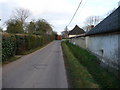
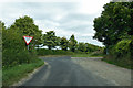
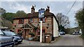
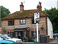
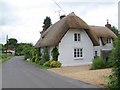
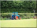

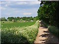
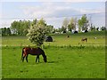
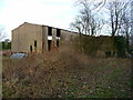
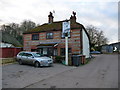
15 photos from this area
Area Information
Key information about the SP11 8PG including its size, population, and administrative classification.
- Area Type
- Postcode
- Area Size
- 1.1 km²
- Population
- 1440
- Population Density
- 63 people/km²
House Prices in SP11 8PG
25
Properties
£589,889
Average Sold Price
£225,000
Lowest Price
£1,000,000
Highest Price
Showing 25 properties
| Address | Type | Beds | Baths | Last Sale Price | Last Sale Date | |
|---|---|---|---|---|---|---|
| Summer Cottage, Down Road, Kimpton, SP11 8PG | Detached | 4 | 2 | £745,000 | Jan 2024 | |
| Poplar Cottage, Down Road, Kimpton, SP11 8PG | Detached | - | - | £1,000,000 | Jun 2023 | |
| Paddock End, Down Road, Kimpton, SP11 8PG | house | - | - | £700,000 | Apr 2021 | |
| Paddock Cottage, Down Road, Kimpton, SP11 8PG | Detached | - | - | £565,000 | Feb 2020 | |
| Kimpton Manor Cottage, Down Road, Kimpton, SP11 8PG | Detached | 5 | 3 | £750,000 | Dec 2019 | |
| Alexander Cottage, Down Road, Kimpton, SP11 8PG | Detached | 3 | 2 | £450,000 | Jan 2010 | |
| Ridgeway Bungalow, Down Road, Kimpton, SP11 8PG | Detached | - | - | £485,000 | Jun 2007 | |
| Little Orchard, Down Road, Kimpton, SP11 8PG | Detached | - | - | £225,000 | Feb 1998 | |
| The Coach House, Down Road, Kimpton, SP11 8PG | Detached | - | - | £389,000 | Oct 1997 | |
| Kimpton Manor Farm House, Down Road, Kimpton, SP11 8PG | Detached | 5 | 2 | - | - |
Page 1 of 3
Energy Efficiency in SP11 8PG
Amenities
Schools
| Rank | School | Type | Entry gender | Ages |
|---|
Explore more schools in this area
Go to Schools tabDemographics
Household Size
Two person
most common
Accommodation Type
Houses
most common
Tenure
74
majority
Ethnic Group
White
most common
Religion
N/A
most common
Household Composition
N/A
most common
Age
47
median
Adults (30-64 years)
most common
Household Deprivation
N/A
with no deprivation
NS-SEC
43
in Lower managerial occupations
Explore more demographic insights in this area
Go to Demographics tabPlanning
Planning Constraints
- Flood RiskPremium
- Ramsar Wetland SitesPremium
- Area of Outstanding Natural BeautyPremium
- Protected Nature ReservePremium
- Protected WoodlandPremium