Area Overview for SP11 8NY
Photos of SP11 8NY
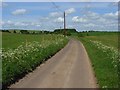
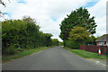
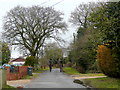
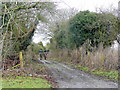
4 photos from this area
Area Information
Key information about the SP11 8NY including its size, population, and administrative classification.
- Area Type
- Postcode
- Area Size
- 34.3 hectares
- Population
- 1440
- Population Density
- 63 people/km²
House Prices in SP11 8NY
27
Properties
£373,750
Average Sold Price
£130,000
Lowest Price
£620,000
Highest Price
Showing 27 properties
| Address | Type | Beds | Baths | Last Sale Price | Last Sale Date | |
|---|---|---|---|---|---|---|
| Afon, Cow Lane, Kimpton, SP11 8NY | Detached | 2 | 1 | £480,000 | Dec 2025 | |
| The Udder Place, Cow Lane, Kimpton, SP11 8NY | Bungalow | - | - | £620,000 | Jan 2025 | |
| Tralee, 3 Cow Lane, Kimpton, SP11 8NY | Terraced | 3 | 1 | £375,000 | Mar 2024 | |
| Cobweb, Cow Lane, Kimpton, SP11 8NY | house | - | - | £250,000 | Mar 2022 | |
| April Cottage, Cow Lane, Kimpton, SP11 8NY | Cottage | 4 | 1 | £570,000 | Dec 2021 | |
| Wayside, Cow Lane, Kimpton, SP11 8NY | house | - | - | £443,000 | Jun 2021 | |
| Tricorne, Cow Lane, Kimpton, SP11 8NY | Detached | - | - | £400,000 | Dec 2018 | |
| Rustlets, Cow Lane, Kimpton, SP11 8NY | Bungalow | - | - | £430,000 | Aug 2017 | |
| The Cottage, Cow Lane, Kimpton, SP11 8NY | house | 2 | - | £332,500 | Aug 2016 | |
| Lynton House, Cow Lane, Kimpton, SP11 8NY | Detached | 4 | 1 | £460,000 | Feb 2016 |
Page 1 of 3
Energy Efficiency in SP11 8NY
Amenities
Schools
| Rank | School | Type | Entry gender | Ages |
|---|
Explore more schools in this area
Go to Schools tabDemographics
Household Size
Two person
most common
Accommodation Type
Houses
most common
Tenure
74
majority
Ethnic Group
White
most common
Religion
N/A
most common
Household Composition
N/A
most common
Age
47
median
Adults (30-64 years)
most common
Household Deprivation
N/A
with no deprivation
NS-SEC
43
in Lower managerial occupations
Explore more demographic insights in this area
Go to Demographics tabPlanning
Planning Constraints
- Flood RiskPremium
- Ramsar Wetland SitesPremium
- Area of Outstanding Natural BeautyPremium
- Protected Nature ReservePremium
- Protected WoodlandPremium