Area Overview for SP11 8AQ
Photos of SP11 8AQ
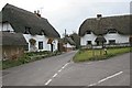
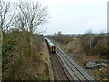
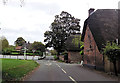
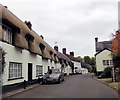
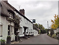
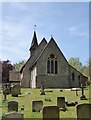
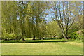
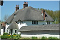
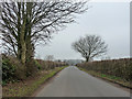
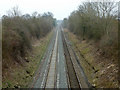
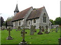
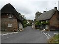
74 photos from this area
Area Information
Key information about the SP11 8AQ including its size, population, and administrative classification.
- Area Type
- Postcode
- Area Size
- 7.5 hectares
- Population
- 2339
- Population Density
- 69 people/km²
House Prices in SP11 8AQ
13
Properties
£821,167
Average Sold Price
£745,000
Lowest Price
£956,000
Highest Price
Showing 13 properties
| Address | Type | Beds | Baths | Last Sale Price | Last Sale Date | |
|---|---|---|---|---|---|---|
| Flagons, Monxton Road, Amport, SP11 8AQ | Detached | 5 | 3 | £745,000 | Sep 2019 | |
| Little Bec, Monxton Road, Amport, SP11 8AQ | Detached | - | - | £956,000 | Oct 2016 | |
| Copper Beeches, Monxton Road, Amport, SP11 8AQ | Detached | 5 | 3 | £762,500 | Aug 2011 | |
| 4, Sarson Barns, Monxton Road, Amport, SP11 8AQ | Detached | 4 | 2 | - | - | |
| 3, Sarson Barns, Monxton Road, Amport, SP11 8AQ | Detached | 5 | 3 | - | - | |
| 1, Broad Meadow, Sarson Barns, Monxton Road, Amport, SP11 8AQ | house | 4 | - | - | - | |
| Flagons, Monxton Road, Amport, SP11 8AQ | undefined | - | - | - | - | |
| 1, Lindisfarne, Monxton Road, Amport, SP11 8AQ | house | - | - | - | - | |
| 2, Sarson Barns, Monxton Road, Amport, SP11 8AQ | house | - | - | - | - | |
| 5, Stonebrook, Sarson Barns, Monxton Road, Amport, SP11 8AQ | Bungalow | - | - | - | - |
Page 1 of 2
Energy Efficiency in SP11 8AQ
Amenities
Schools
| Rank | School | Type | Entry gender | Ages |
|---|
Explore more schools in this area
Go to Schools tabDemographics
Household Size
Two person
most common
Accommodation Type
Houses
most common
Tenure
75
majority
Ethnic Group
White
most common
Religion
N/A
most common
Household Composition
N/A
most common
Age
47
median
Adults (30-64 years)
most common
Household Deprivation
N/A
with no deprivation
NS-SEC
41
in Lower managerial occupations
Explore more demographic insights in this area
Go to Demographics tabPlanning
Planning Constraints
- Flood RiskPremium
- Ramsar Wetland SitesPremium
- Area of Outstanding Natural BeautyPremium
- Protected Nature ReservePremium
- Protected WoodlandPremium