Area Overview for SP11 8AH
Photos of SP11 8AH
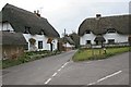
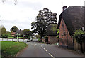
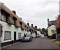
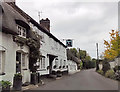
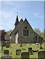
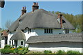
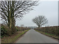
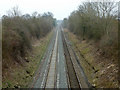
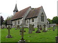
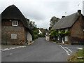
74 photos from this area
Area Information
Key information about the SP11 8AH including its size, population, and administrative classification.
- Area Type
- Postcode
- Area Size
- 31.1 hectares
- Population
- 2339
- Population Density
- 69 people/km²
House Prices in SP11 8AH
11
Properties
£923,033
Average Sold Price
£475,000
Lowest Price
£2,525,000
Highest Price
Showing 11 properties
| Address | Type | Beds | Baths | Last Sale Price | Last Sale Date | |
|---|---|---|---|---|---|---|
| Newcott, Amport Road, Monxton, SP11 8AH | Retail | 4 | 2 | £570,000 | Mar 2024 | |
| Corner Cottage, Amport Road, Monxton, SP11 8AH | Detached | 4 | 3 | £975,000 | Nov 2023 | |
| Bec House, Amport Road, Monxton, SP11 8AH | Detached | - | - | £2,525,000 | May 2021 | |
| Boundary Cottage, Amport Road, Monxton, SP11 8AH | house | - | - | £500,000 | Sep 2019 | |
| Church Hill House, Amport Road, Monxton, SP11 8AH | Detached | 5 | 2 | £475,000 | Sep 2018 | |
| Rectory Cottage, Amport Road, Monxton, SP11 8AH | Detached | 4 | 3 | £493,200 | Jan 2000 | |
| Monxton Manor, Amport Road, Monxton, SP11 8AH | Cottage | 7 | - | - | - | |
| Coach House, Monxton Manor, Amport Road, Monxton, SP11 8AH | Flat | - | - | - | - | |
| Manor Farm, Amport Road, Monxton, SP11 8AH | Detached | - | - | - | - | |
| The School House, Amport Road, Monxton, SP11 8AH | house | - | - | - | - |
Page 1 of 2
Energy Efficiency in SP11 8AH
Amenities
Schools
| Rank | School | Type | Entry gender | Ages |
|---|
Explore more schools in this area
Go to Schools tabDemographics
Household Size
Two person
most common
Accommodation Type
Houses
most common
Tenure
75
majority
Ethnic Group
White
most common
Religion
N/A
most common
Household Composition
N/A
most common
Age
47
median
Adults (30-64 years)
most common
Household Deprivation
N/A
with no deprivation
NS-SEC
41
in Lower managerial occupations
Explore more demographic insights in this area
Go to Demographics tabPlanning
Planning Constraints
- Flood RiskPremium
- Ramsar Wetland SitesPremium
- Area of Outstanding Natural BeautyPremium
- Protected Nature ReservePremium
- Protected WoodlandPremium