Area Overview for SP11 7JF
Photos of SP11 7JF
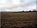
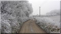
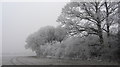
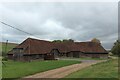
9 photos from this area
Area Information
Key information about the SP11 7JF including its size, population, and administrative classification.
- Area Type
- Postcode
- Area Size
- 2.2 hectares
- Population
- 2288
- Population Density
- 36 people/km²
House Prices in SP11 7JF
5
Properties
£860,000
Average Sold Price
£860,000
Lowest Price
£860,000
Highest Price
Showing 5 properties
| Address | Type | Beds | Baths | Last Sale Price | Last Sale Date | |
|---|---|---|---|---|---|---|
| Gavel Acre, Winchester Road, Wherwell, SP11 7JF | Cottage | 4 | - | £860,000 | Nov 2020 | |
| St Michaels, New Barn Lane, Wherwell, SP11 7JF | Detached | 4 | 1 | - | - | |
| William Stewart Hair Design, Twentieth Century Stores, Winchester Road, Wherwell, SP11 7JF | shop | - | - | - | - | |
| The White Lion, Winchester Road, Wherwell, SP11 7JF | restaurant_cafe | - | - | - | - | |
| Landlords Flat, The White Lion, Winchester Road, Wherwell, SP11 7JF | Flat | - | - | - | - |
Energy Efficiency in SP11 7JF
Amenities
Schools
| Rank | School | Type | Entry gender | Ages |
|---|
Explore more schools in this area
Go to Schools tabDemographics
Household Size
Two person
most common
Accommodation Type
Houses
most common
Tenure
66
majority
Ethnic Group
White
most common
Religion
N/A
most common
Household Composition
N/A
most common
Age
47
median
Adults (30-64 years)
most common
Household Deprivation
N/A
with no deprivation
NS-SEC
44
in Lower managerial occupations
Explore more demographic insights in this area
Go to Demographics tabPlanning
Planning Constraints
- Flood RiskPremium
- Ramsar Wetland SitesPremium
- Area of Outstanding Natural BeautyPremium
- Protected Nature ReservePremium
- Protected WoodlandPremium