Area Overview for SP11 6PB
Photos of SP11 6PB
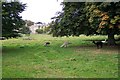
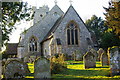
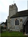
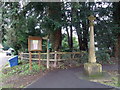
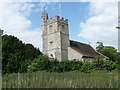
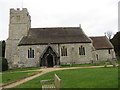
57 photos from this area
Area Information
Key information about the SP11 6PB including its size, population, and administrative classification.
- Area Type
- Postcode
- Area Size
- 25.4 hectares
- Population
- 2288
- Population Density
- 36 people/km²
House Prices in SP11 6PB
10
Properties
£1,411,178
Average Sold Price
£815,000
Lowest Price
£1,850,000
Highest Price
Showing 10 properties
| Address | Type | Beds | Baths | Last Sale Price | Last Sale Date | |
|---|---|---|---|---|---|---|
| The Cottage, Longparish, Andover, SP11 6PB | Detached | 6 | 2 | £1,850,000 | May 2024 | |
| The Old Curacy, Longparish, Andover, SP11 6PB | Detached | - | - | £1,200,888 | Feb 2022 | |
| Woodbury House, Longparish, Andover, SP11 6PB | Detached | - | - | £1,700,000 | Jun 2015 | |
| Greenholme, Longparish, Andover, SP11 6PB | Retail | 4 | 2 | £1,490,000 | Jun 2015 | |
| White Windows, Longparish, Andover, SP11 6PB | house | - | - | £815,000 | May 2010 | |
| Landlords Flat, Plough Inn, Longparish, Andover, SP11 6PB | Flat | - | - | - | - | |
| Owl Lodge Farm, Nuns Walk, Longparish, SP11 6PB | Detached | - | - | - | - | |
| Orchard House, Longparish, Andover, SP11 6PB | Detached | 7 | 4 | - | - | |
| The Barton, Longparish, Andover, SP11 6PB | Detached | - | - | - | - | |
| Greenacre, Longparish, Andover, SP11 6PB | house | - | - | - | - |
Energy Efficiency in SP11 6PB
Amenities
Schools
| Rank | School | Type | Entry gender | Ages |
|---|
Explore more schools in this area
Go to Schools tabDemographics
Household Size
Two person
most common
Accommodation Type
Houses
most common
Tenure
66
majority
Ethnic Group
White
most common
Religion
N/A
most common
Household Composition
N/A
most common
Age
47
median
Adults (30-64 years)
most common
Household Deprivation
N/A
with no deprivation
NS-SEC
44
in Lower managerial occupations
Explore more demographic insights in this area
Go to Demographics tabPlanning
Planning Constraints
- Flood RiskPremium
- Ramsar Wetland SitesPremium
- Area of Outstanding Natural BeautyPremium
- Protected Nature ReservePremium
- Protected WoodlandPremium