Area Overview for SP11 6NU
Photos of SP11 6NU

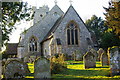
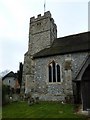
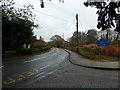


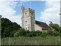
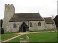
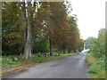
57 photos from this area
Area Information
Key information about the SP11 6NU including its size, population, and administrative classification.
- Area Type
- Postcode
- Area Size
- 62.9 hectares
- Population
- 2288
- Population Density
- 36 people/km²
House Prices in SP11 6NU
31
Properties
£589,821
Average Sold Price
£115,000
Lowest Price
£1,375,000
Highest Price
Showing 31 properties
| Address | Type | Beds | Baths | Last Sale Price | Last Sale Date | |
|---|---|---|---|---|---|---|
| Tribbeck Cottage, 1 Forton Lane, Forton, SP11 6NU | Semi-detached | 3 | 1 | £535,000 | Nov 2024 | |
| Barley Cottage, Forton Lane, Forton, SP11 6NU | house | 3 | - | £625,000 | Oct 2022 | |
| Kingfisher Cottage, Forton Lane, Forton, SP11 6NU | Cottage | 3 | - | £585,000 | Jun 2021 | |
| The Dial House, Forton Lane, Forton, SP11 6NU | house | - | - | £677,500 | Dec 2020 | |
| River Cottage, Forton Lane, Forton, SP11 6NU | Detached | 5 | - | £1,375,000 | Apr 2018 | |
| Owls Lodge, Forton Lane, Forton, SP11 6NU | Detached | 3 | - | £625,000 | Aug 2014 | |
| The Barn House, Forton Lane, Forton, SP11 6NU | Detached | 5 | 3 | £750,000 | Aug 2014 | |
| Apple Tree Cottage, Forton Lane, Forton, SP11 6NU | house | 4 | - | £380,000 | Nov 2009 | |
| Meadow Cottage, Forton Lane, Forton, SP11 6NU | house | - | - | £750,000 | Nov 2009 | |
| Sirrah Cottage, 9 Forton Lane, Forton, SP11 6NU | Terraced | - | - | £325,000 | Aug 2006 |
Page 1 of 4
Energy Efficiency in SP11 6NU
Amenities
Schools
| Rank | School | Type | Entry gender | Ages |
|---|
Explore more schools in this area
Go to Schools tabDemographics
Household Size
Two person
most common
Accommodation Type
Houses
most common
Tenure
66
majority
Ethnic Group
White
most common
Religion
N/A
most common
Household Composition
N/A
most common
Age
47
median
Adults (30-64 years)
most common
Household Deprivation
N/A
with no deprivation
NS-SEC
44
in Lower managerial occupations
Explore more demographic insights in this area
Go to Demographics tabPlanning
Planning Constraints
- Flood RiskPremium
- Ramsar Wetland SitesPremium
- Area of Outstanding Natural BeautyPremium
- Protected Nature ReservePremium
- Protected WoodlandPremium