Area Overview for SP11 0RQ
Photos of SP11 0RQ
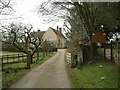
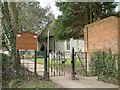
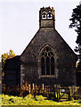
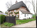
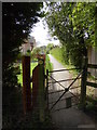
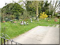
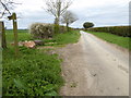
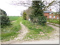
25 photos from this area
Area Information
Key information about the SP11 0RQ including its size, population, and administrative classification.
- Area Type
- Postcode
- Area Size
- 23.5 hectares
- Population
- 1662
- Population Density
- 112 people/km²
House Prices in SP11 0RQ
39
Properties
£596,144
Average Sold Price
£107,000
Lowest Price
£1,646,000
Highest Price
Showing 39 properties
| Address | Type | Beds | Baths | Last Sale Price | Last Sale Date | |
|---|---|---|---|---|---|---|
| Willowmeade, Chalkcroft Lane, Penton Mewsey, SP11 0RQ | Detached | 5 | 3 | £1,065,000 | Jan 2024 | |
| Staddlestones, Chalkcroft Lane, Penton Mewsey, SP11 0RQ | Detached | 4 | - | £791,241 | May 2023 | |
| Paddocks, Chalkcroft Lane, Penton Mewsey, SP11 0RQ | house | - | - | £750,000 | Sep 2022 | |
| Northcombe, Chalkcroft Lane, Penton Mewsey, SP11 0RQ | house | - | - | £1,350,000 | Aug 2022 | |
| Aldermans Cottage, Chalkcroft Lane, Penton Mewsey, SP11 0RQ | Detached | 5 | 2 | £880,000 | Oct 2021 | |
| Leggatts, Chalkcroft Lane, Penton Mewsey, SP11 0RQ | Retail | 4 | - | £1,646,000 | Dec 2020 | |
| Folly Cottage, Chalkcroft Lane, Penton Mewsey, SP11 0RQ | Detached | 4 | 1 | £850,000 | Sep 2019 | |
| Grove Villa, Chalkcroft Lane, Penton Mewsey, SP11 0RQ | Semi-detached | 3 | 1 | £282,500 | Dec 2018 | |
| Glebe House, Chalkcroft Lane, Penton Mewsey, SP11 0RQ | Detached | 4 | 2 | £725,000 | Sep 2015 | |
| Laurel Cottage, Chalkcroft Lane, Penton Mewsey, SP11 0RQ | house | 3 | - | £530,000 | Aug 2015 |
Page 1 of 4
Energy Efficiency in SP11 0RQ
Amenities
Schools
| Rank | School | Type | Entry gender | Ages |
|---|
Explore more schools in this area
Go to Schools tabDemographics
Household Size
Two person
most common
Accommodation Type
Houses
most common
Tenure
73
majority
Ethnic Group
White
most common
Religion
N/A
most common
Household Composition
N/A
most common
Age
47
median
Adults (30-64 years)
most common
Household Deprivation
N/A
with no deprivation
NS-SEC
45
in Lower managerial occupations
Explore more demographic insights in this area
Go to Demographics tabPlanning
Planning Constraints
- Flood RiskPremium
- Ramsar Wetland SitesPremium
- Area of Outstanding Natural BeautyPremium
- Protected Nature ReservePremium
- Protected WoodlandPremium