Area Overview for SP11 0HD
Photos of SP11 0HD
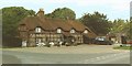
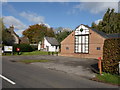
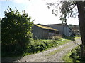
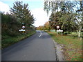
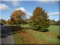
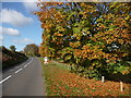
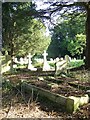
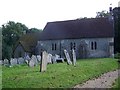
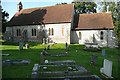
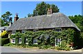
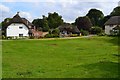
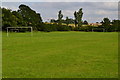
71 photos from this area
Area Information
Key information about the SP11 0HD including its size, population, and administrative classification.
- Area Type
- Postcode
- Area Size
- 11.2 hectares
- Population
- 2102
- Population Density
- 32 people/km²
House Prices in SP11 0HD
26
Properties
£292,454
Average Sold Price
£30,000
Lowest Price
£520,000
Highest Price
Showing 26 properties
| Address | Type | Beds | Baths | Last Sale Price | Last Sale Date | |
|---|---|---|---|---|---|---|
| The Hayrick, Shepherds Rise, Vernham Dean, SP11 0HD | Semi-detached | 4 | 2 | £495,000 | Mar 2024 | |
| 20 Shepherds Rise, Vernham Dean, SP11 0HD | Detached | 4 | 1 | £508,000 | Jun 2021 | |
| Four Seasons, 11 Shepherds Rise, Vernham Dean, SP11 0HD | house | 4 | 2 | £465,000 | Mar 2021 | |
| 23 Shepherds Rise, Vernham Dean, SP11 0HD | Detached | 4 | 2 | £520,000 | Sep 2020 | |
| 6 Shepherds Rise, Vernham Dean, SP11 0HD | Terraced | 4 | 3 | £435,000 | Dec 2019 | |
| 3 Shepherds Rise, Vernham Dean, SP11 0HD | house | - | - | £321,000 | Apr 2016 | |
| 17 Shepherds Rise, Vernham Dean, SP11 0HD | Detached | 4 | 2 | £365,000 | Jul 2015 | |
| 19 Shepherds Rise, Vernham Dean, SP11 0HD | house | - | - | £370,000 | Jan 2013 | |
| 5 Shepherds Rise, Vernham Dean, SP11 0HD | Semi-detached | - | - | £244,000 | Nov 2012 | |
| Haydown, 10 Shepherds Rise, Vernham Dean, SP11 0HD | house | - | - | £249,950 | Dec 2010 |
Page 1 of 3
Energy Efficiency in SP11 0HD
Amenities
Schools
| Rank | School | Type | Entry gender | Ages |
|---|
Explore more schools in this area
Go to Schools tabDemographics
Household Size
Two person
most common
Accommodation Type
Houses
most common
Tenure
70
majority
Ethnic Group
White
most common
Religion
N/A
most common
Household Composition
N/A
most common
Age
47
median
Adults (30-64 years)
most common
Household Deprivation
N/A
with no deprivation
NS-SEC
46
in Lower managerial occupations
Explore more demographic insights in this area
Go to Demographics tabPlanning
Planning Constraints
- Flood RiskPremium
- Ramsar Wetland SitesPremium
- Area of Outstanding Natural BeautyPremium
- Protected Nature ReservePremium
- Protected WoodlandPremium