Area Overview for South Oxfordshire District
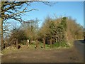
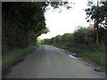
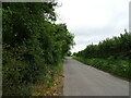
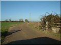
Photos of South Oxfordshire District


Area Information
South Oxfordshire District is a substantial local authority covering 678.9 square kilometres of south-east England. This vast area provides a wide canvas for living, though it spans diverse geographical features rather than forming a single compact town. You will find habitats ranging from protected woodlands to designated Areas of Outstanding Natural Beauty. The region offers a quiet lifestyle removed from urban congestion, making it suitable for those prioritising space and tranquillity over city amenities. Daily life here revolves around a connection to the countryside and local settlements rather than high-density development. Living in South Oxfordshire District means accepting a reliance on local services due to the district's significant size. The landscape contains specific planning constraints, including protected nature reserves and woodlands, which shape development potential. You are entering an environment where the built environment competes with substantial natural heritage. The area balances rural charm with the practical realities of managing a large geographic footprint. Families and retirees often seek this setting, appreciating the wide-open spaces despite the limitations on percentage of government housing or density. The community profile in South Oxfordshire District is very distinct compared to national averages. The median age stands at 70 years old, indicating a population dominated by older residents. You are largely looking at an area where life slows down as families grow older. Home ownership is prevalent at 72%, suggesting that most people who buy homes in South Oxfordshire District keep them for the long term. This high rate of ownership typically aligns with a retirement demographic or established residents who have Stayed their whole lives in the area. Household composition data indicates a total count without a specific breakdown of single-person or family units in the provided figures. You cannot determine the exact percentage of empty nesters versus younger couples without further detail, but the age profile is clear. The area does not appear to be a young professional hub or a primary educational commute zone based on the age median. Diversity data regarding predominant ethnicity and religion are not detailed in the current dataset, so you should assume a relatively standard demographic mix for the region. The population structure points to stability rather than rapid growth or influx. The housing market in South Oxfordshire District is defined by traditional British accommodation types rather than modern high-rise blocks. With 72% of the population owning their homes, the market functions primarily as an owner-occupied area rather than a high-rental zone. Most homes in South Oxfordshire District are likely detached or semi-detached properties suited to the rural and semi-rural landscape. You will find a lack of purpose-built social housing blocks in the majority of the district. Accommodation type data confirms that the stock consists of total residential units designed for full-time living. Prospective buyers should expect a market where resale values depend on individual property conditions and proximity to local towns. The high ownership rate means sellers often have strong emotional ties to their properties. This dynamic can slow down transactions if owners are reluctant to move. You are entering a market where price reflects location quality and property maintenance rather than speculative investment potential. The accommodation reflects the needs of a settled, older populace seeking stability and space. Digital connectivity in South Oxfordshire District presents significant challenges for remote workers and heavy internet users. The mobile coverage score records at 73 out of 100, which rates as a fairly good standard for voice and basic data services. You can expect reliable mobile networks for most essential calls and messaging throughout the district. However, the fixed broadband score sits at just 29 out of 100. This rate describes a poor quality connection for internet, streaming, or large file transfers. Living in South Oxfordshire District means you might struggle with high-speed broadband if you work from home regularly. The low broadband score contrasts sharply with the decent mobile signal, meaning backup connections rely on mobile hotspots or 4G/5G adapters. You should treat internet infrastructure as a limiting factor for any business plan dependent on constant online presence. Daily internet use for uploading documents or video conferencing may experience noticeable latency. Residents with heavy digital needs must accommodate for these constraints before committing to a property in the area. Safety and environmental factors mix concerns with reassurance in South Oxfordshire District. The crime risk assessment shows a score of 79 out of 100, which indicates a low crime risk. This area has below-average crime rates, making it a safer neighbourhood compared to many urban locations. You can walk or cycle within the district with reasonable confidence regarding personal security. Conversely, environmental risks present a more complex picture for residents. The district carries a medium flood risk with a warning level score of 21.03. Residents must consider water levels when choosing properties near rivers or low-lying ground. Planning constraints further limit development, protecting 42.01 score points of the Area of Outstanding Natural Beauty. The district also contains protected nature reserves with a warning level score of 0.62. Additionally, 6.74 score points relate to protected woodland areas. These constraints ensure the environment remains largely wild but mean you cannot build freely on any plot. You inherit both safety and ecological responsibility when living here. What is the typical age of residents in South Oxfordshire District?The median age in South Oxfordshire District is 70 years old. This indicates a population heavily skewed towards older adults rather than young families or professionals. The demographic profile shows a community settled in retirement or established residence. You should expect neighbours to be in a similar age bracket to yourself if you are looking for this quiet lifestyle. How strong is the internet connection for working from home?Fixed broadband in South Oxfordshire District scores only 29 out of 100, indicating a poor quality connection for serious work or streaming. While mobile coverage is fairly good at 73 out of 100, you cannot rely on high-speed fibre for large downloads or video calls. You must build a robust backup plan for your digital needs. Is South Oxfordshire District considered a safe place to live?Yes, the area has a low crime risk with a safety score of 79 out of 100. This places it below the average for crime rates across the country. You will find that personal safety is generally high, allowing you to enjoy a relaxed life without constant security concerns. Are there major environmental restrictions I should know about?The district includes areas within an Area of Outstanding Natural Beauty with a planning score of 42.01. It also contains protected nature reserves and woodlands. These conservation zones mean new development is strictly limited. You are buying into a protected landscape where the environment takes priority over expansion.
- Area Type
- District/Borough
- Area Size
- 678.9 km²
- Population
- Not available
- Population Density
- Not available
Demographics
The community profile in South Oxfordshire District is very distinct compared to national averages. The median age stands at 70 years old, indicating a population dominated by older residents. You are largely looking at an area where life slows down as families grow older. Home ownership is prevalent at 72%, suggesting that most people who buy homes in South Oxfordshire District keep them for the long term. This high rate of ownership typically aligns with a retirement demographic or established residents who have Stayed their whole lives in the area. Household composition data indicates a total count without a specific breakdown of single-person or family units in the provided figures. You cannot determine the exact percentage of empty nesters versus younger couples without further detail, but the age profile is clear. The area does not appear to be a young professional hub or a primary educational commute zone based on the age median. Diversity data regarding predominant ethnicity and religion are not detailed in the current dataset, so you should assume a relatively standard demographic mix for the region. The population structure points to stability rather than rapid growth or influx. The housing market in South Oxfordshire District is defined by traditional British accommodation types rather than modern high-rise blocks. With 72% of the population owning their homes, the market functions primarily as an owner-occupied area rather than a high-rental zone. Most homes in South Oxfordshire District are likely detached or semi-detached properties suited to the rural and semi-rural landscape. You will find a lack of purpose-built social housing blocks in the majority of the district. Accommodation type data confirms that the stock consists of total residential units designed for full-time living. Prospective buyers should expect a market where resale values depend on individual property conditions and proximity to local towns. The high ownership rate means sellers often have strong emotional ties to their properties. This dynamic can slow down transactions if owners are reluctant to move. You are entering a market where price reflects location quality and property maintenance rather than speculative investment potential. The accommodation reflects the needs of a settled, older populace seeking stability and space. Digital connectivity in South Oxfordshire District presents significant challenges for remote workers and heavy internet users. The mobile coverage score records at 73 out of 100, which rates as a fairly good standard for voice and basic data services. You can expect reliable mobile networks for most essential calls and messaging throughout the district. However, the fixed broadband score sits at just 29 out of 100. This rate describes a poor quality connection for internet, streaming, or large file transfers. Living in South Oxfordshire District means you might struggle with high-speed broadband if you work from home regularly. The low broadband score contrasts sharply with the decent mobile signal, meaning backup connections rely on mobile hotspots or 4G/5G adapters. You should treat internet infrastructure as a limiting factor for any business plan dependent on constant online presence. Daily internet use for uploading documents or video conferencing may experience noticeable latency. Residents with heavy digital needs must accommodate for these constraints before committing to a property in the area. Safety and environmental factors mix concerns with reassurance in South Oxfordshire District. The crime risk assessment shows a score of 79 out of 100, which indicates a low crime risk. This area has below-average crime rates, making it a safer neighbourhood compared to many urban locations. You can walk or cycle within the district with reasonable confidence regarding personal security. Conversely, environmental risks present a more complex picture for residents. The district carries a medium flood risk with a warning level score of 21.03. Residents must consider water levels when choosing properties near rivers or low-lying ground. Planning constraints further limit development, protecting 42.01 score points of the Area of Outstanding Natural Beauty. The district also contains protected nature reserves with a warning level score of 0.62. Additionally, 6.74 score points relate to protected woodland areas. These constraints ensure the environment remains largely wild but mean you cannot build freely on any plot. You inherit both safety and ecological responsibility when living here. What is the typical age of residents in South Oxfordshire District?The median age in South Oxfordshire District is 70 years old. This indicates a population heavily skewed towards older adults rather than young families or professionals. The demographic profile shows a community settled in retirement or established residence. You should expect neighbours to be in a similar age bracket to yourself if you are looking for this quiet lifestyle. How strong is the internet connection for working from home?Fixed broadband in South Oxfordshire District scores only 29 out of 100, indicating a poor quality connection for serious work or streaming. While mobile coverage is fairly good at 73 out of 100, you cannot rely on high-speed fibre for large downloads or video calls. You must build a robust backup plan for your digital needs. Is South Oxfordshire District considered a safe place to live?Yes, the area has a low crime risk with a safety score of 79 out of 100. This places it below the average for crime rates across the country. You will find that personal safety is generally high, allowing you to enjoy a relaxed life without constant security concerns. Are there major environmental restrictions I should know about?The district includes areas within an Area of Outstanding Natural Beauty with a planning score of 42.01. It also contains protected nature reserves and woodlands. These conservation zones mean new development is strictly limited. You are buying into a protected landscape where the environment takes priority over expansion.
Household Size
Accommodation Type
Tenure
Ethnic Group
Religion
Household Composition
Age
Household Deprivation
NS-SEC
Explore more demographic insights in this area
Go to Demographics tabPlanning
Planning Constraints
- Flood RiskPremium
- Ramsar Wetland SitesPremium
- Area of Outstanding Natural BeautyPremium
- Protected Nature ReservePremium
- Protected WoodlandPremium
- Crime RiskPremium