Area Overview for Cherwell District
Photos of Cherwell District
Area Information
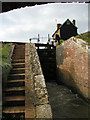
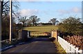
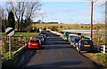
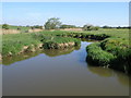
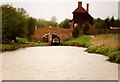
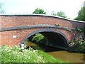
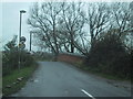
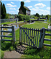
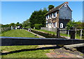
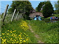
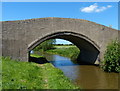
Cherwell District spans 589.1 km² across northern Oxfordshire, representing a varied landscape that you will find stretches from rolling hills to waterways. The River Cherwell bisects the area, flowing into the Thames at Oxford, while the Oxford Canal runs nearby, defining the geography of towns like Kidlington and surrounding villages. You will encounter market towns such as Banbury, which serves as the administrative centre, alongside Bicester, both of which act as commercial hubs within this largely rural district. Local heritage includes historic estates like Rousham House and the market square in Banbury, offering a distinct character compared to busy metropolitan counties. This district established on 1 April 1974, merging several rural and urban areas under a single local authority. Daily life often revolves around these market towns, where agriculture remains a significant economic driver alongside growing residential and commercial zones. You might navigate past farmland and countryside before reaching the built-up areas of Banbury or the large village of Kidlington. The area sits between the Cotswolds uplands to the west and the North Oxfordshire Heights to the north, creating a diverse environment for those seeking homes in Cherwell District without urban density.
- Area Type
- District/Borough
- Area Size
- 589.1 km²
- Population
- Not available
- Population Density
- Not available
Demographics
The community profile in Cherwell District reflects a mature demographic landscape suitable for specific life stages. You will find a median age of 70, which is notably higher than most urban districts, indicating a significant presence of older residents across the borough. This age profile suggests that many families may have moved to improved housing or retired locally, shaping the overall character of the neighbourhoods. Approximately 67% of households own their homes, revealing a strong culture of home ownership rather than a predominance of private renting. This high ownership rate often correlates with stability in the local community and long-term investment by residents. The data does not specify the breakdown of household composition types or ethnic groups, but the age implications are clear regarding the lifestyle needs of the population. For anyone considering living in Cherwell District, an environment dominated by older adults and substantial owner-occupier numbers might influence the pace of local services and social activities. You should expect a quieter demographic than in younger, broader urban centres, making it a distinct choice for retirement or families in later stages of life seeking a settled environment.
Household Size
Accommodation Type
Tenure
Ethnic Group
Religion
Household Composition
Age
Household Deprivation
NS-SEC
Explore more demographic insights in this area
Go to Demographics tabPlanning
Planning Constraints
- Flood RiskPremium
- Ramsar Wetland SitesPremium
- Area of Outstanding Natural BeautyPremium
- Protected Nature ReservePremium
- Protected WoodlandPremium
- Crime RiskPremium