Area Overview for SO51 6AG
Photos of SO51 6AG

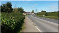

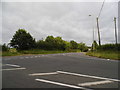


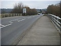
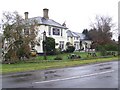

32 photos from this area
Area Information
Key information about the SO51 6AG including its size, population, and administrative classification.
- Area Type
- Postcode
- Area Size
- 63.6 hectares
- Population
- 1475
- Population Density
- 143 people/km²
House Prices in SO51 6AG
20
Properties
£518,989
Average Sold Price
£140,000
Lowest Price
£1,250,000
Highest Price
Showing 20 properties
| Address | Type | Beds | Baths | Last Sale Price | Last Sale Date | |
|---|---|---|---|---|---|---|
| Conway, Salisbury Road, Ower, SO51 6AG | Detached | 4 | 1 | £770,000 | Sep 2024 | |
| Oaklands, Salisbury Road, Ower, SO51 6AG | Detached | 3 | - | £575,000 | Apr 2023 | |
| Golden Hayes, Salisbury Road, Ower, SO51 6AG | Detached | 4 | 3 | £799,950 | Mar 2022 | |
| Elken House, Salisbury Road, Ower, SO51 6AG | Detached | 5 | 4 | £1,250,000 | Jan 2021 | |
| Tosca, Salisbury Road, Ower, SO51 6AG | Bungalow | 3 | 1 | £399,950 | Feb 2017 | |
| Kingfisher, Salisbury Road, Ower, SO51 6AG | Detached | 4 | 2 | £426,000 | Sep 2008 | |
| Moorview, Salisbury Road, Ower, SO51 6AG | Bungalow | 4 | 2 | £165,000 | Mar 2002 | |
| The Nestlings, Salisbury Road, Ower, SO51 6AG | Detached | - | - | £140,000 | Jun 1997 | |
| Brookside, Salisbury Road, Ower, SO51 6AG | Detached | - | - | £145,000 | Sep 1996 | |
| Nevaster, Salisbury Road, Ower, SO51 6AG | Detached | - | - | - | - |
Page 1 of 2
Energy Efficiency in SO51 6AG
Amenities
Schools
| Rank | School | Type | Entry gender | Ages |
|---|
Explore more schools in this area
Go to Schools tabDemographics
Household Size
Two person
most common
Accommodation Type
Houses
most common
Tenure
87
majority
Ethnic Group
White
most common
Religion
N/A
most common
Household Composition
N/A
most common
Age
47
median
Adults (30-64 years)
most common
Household Deprivation
N/A
with no deprivation
NS-SEC
39
in Lower managerial occupations
Explore more demographic insights in this area
Go to Demographics tabPlanning
Planning Constraints
- Flood RiskPremium
- Ramsar Wetland SitesPremium
- Area of Outstanding Natural BeautyPremium
- Protected Nature ReservePremium
- Protected WoodlandPremium