Area Overview for SO50 7PD
Photos of SO50 7PD
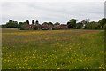

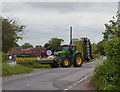
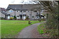


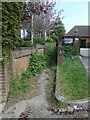
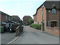

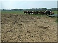
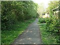
31 photos from this area
Area Information
Key information about the SO50 7PD including its size, population, and administrative classification.
- Area Type
- Postcode
- Area Size
- 1.5 hectares
- Population
- 1676
- Population Density
- 2912 people/km²
House Prices in SO50 7PD
26
Properties
£258,328
Average Sold Price
£87,500
Lowest Price
£560,000
Highest Price
Showing 26 properties
| Address | Type | Beds | Baths | Last Sale Price | Last Sale Date | |
|---|---|---|---|---|---|---|
| 4 Meadowsweet Way, Horton Heath, SO50 7PD | Terraced | 2 | 1 | £277,500 | Aug 2025 | |
| 14 Meadowsweet Way, Horton Heath, SO50 7PD | Terraced | 2 | 1 | £270,000 | Jul 2025 | |
| 8 Meadowsweet Way, Horton Heath, SO50 7PD | Terraced | 2 | 1 | £295,000 | Jun 2025 | |
| 18 Meadowsweet Way, Horton Heath, SO50 7PD | Terraced | 2 | 1 | £285,000 | Mar 2025 | |
| 6 Meadowsweet Way, Horton Heath, SO50 7PD | Terraced | 2 | 1 | £257,500 | Jan 2024 | |
| 36 Meadowsweet Way, Horton Heath, SO50 7PD | house | - | - | £404,000 | Sep 2022 | |
| Talloires, 42 Meadowsweet Way, Horton Heath, SO50 7PD | Retail | 4 | 2 | £510,000 | Apr 2022 | |
| 34 Meadowsweet Way, Horton Heath, SO50 7PD | house | - | - | £375,000 | Oct 2020 | |
| 48 Meadowsweet Way, Horton Heath, SO50 7PD | Detached | 5 | 3 | £560,000 | Sep 2018 | |
| 16 Meadowsweet Way, Horton Heath, SO50 7PD | Detached | 2 | - | £175,000 | Apr 2013 |
Page 1 of 3
Energy Efficiency in SO50 7PD
Amenities
Schools
| Rank | School | Type | Entry gender | Ages |
|---|
Explore more schools in this area
Go to Schools tabDemographics
Household Size
Family (3-5 people)
most common
Accommodation Type
Houses
most common
Tenure
87
majority
Ethnic Group
White
most common
Religion
N/A
most common
Household Composition
N/A
most common
Age
47
median
Adults (30-64 years)
most common
Household Deprivation
N/A
with no deprivation
NS-SEC
46
in Lower managerial occupations
Explore more demographic insights in this area
Go to Demographics tabPlanning
Planning Constraints
- Flood RiskPremium
- Ramsar Wetland SitesPremium
- Area of Outstanding Natural BeautyPremium
- Protected Nature ReservePremium
- Protected WoodlandPremium