Area Overview for SO50 7PA
Photos of SO50 7PA
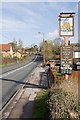


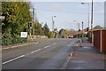
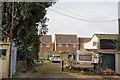

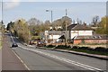


71 photos from this area
Area Information
Key information about the SO50 7PA including its size, population, and administrative classification.
- Area Type
- Postcode
- Area Size
- 3.3 hectares
- Population
- 2029
- Population Density
- 1240 people/km²
House Prices in SO50 7PA
36
Properties
£292,148
Average Sold Price
£68,000
Lowest Price
£560,000
Highest Price
Showing 36 properties
| Address | Type | Beds | Baths | Last Sale Price | Last Sale Date | |
|---|---|---|---|---|---|---|
| 53 Angelica Gardens, Horton Heath, SO50 7PA | Detached | 4 | 2 | £560,000 | Nov 2025 | |
| 15 Angelica Gardens, Horton Heath, SO50 7PA | Semi-detached | 3 | 1 | £340,000 | Sep 2024 | |
| 19 Angelica Gardens, Horton Heath, SO50 7PA | house | 2 | 1 | £285,000 | Mar 2024 | |
| 43 Angelica Gardens, Horton Heath, SO50 7PA | Semi-detached | - | - | £390,000 | Feb 2024 | |
| 3 Angelica Gardens, Horton Heath, SO50 7PA | Detached | 4 | 2 | £487,500 | Sep 2023 | |
| 29 Angelica Gardens, Horton Heath, SO50 7PA | house | 2 | 2 | £300,000 | Dec 2022 | |
| 37 Angelica Gardens, Horton Heath, SO50 7PA | Detached | 4 | 2 | £495,000 | Nov 2022 | |
| 63 Angelica Gardens, Horton Heath, SO50 7PA | Detached | 4 | 3 | £453,000 | Feb 2021 | |
| 11 Angelica Gardens, Horton Heath, SO50 7PA | Detached | 4 | 1 | £369,950 | Feb 2021 | |
| 59 Angelica Gardens, Horton Heath, SO50 7PA | Detached | 4 | 2 | £357,000 | Jul 2020 |
Page 1 of 4
Energy Efficiency in SO50 7PA
Amenities
Schools
| Rank | School | Type | Entry gender | Ages |
|---|
Explore more schools in this area
Go to Schools tabDemographics
Household Size
Family (3-5 people)
most common
Accommodation Type
Houses
most common
Tenure
87
majority
Ethnic Group
White
most common
Religion
N/A
most common
Household Composition
N/A
most common
Age
47
median
Adults (30-64 years)
most common
Household Deprivation
N/A
with no deprivation
NS-SEC
44
in Lower managerial occupations
Explore more demographic insights in this area
Go to Demographics tabPlanning
Planning Constraints
- Flood RiskPremium
- Ramsar Wetland SitesPremium
- Area of Outstanding Natural BeautyPremium
- Protected Nature ReservePremium
- Protected WoodlandPremium