Area Overview for SO43 7JH
Photos of SO43 7JH
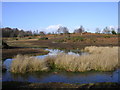
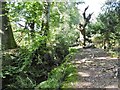
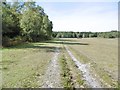
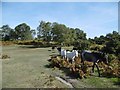


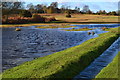
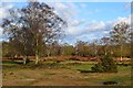


33 photos from this area
Area Information
Key information about the SO43 7JH including its size, population, and administrative classification.
- Area Type
- Postcode
- Area Size
- 3.0 km²
- Population
- 1316
- Population Density
- 20 people/km²
House Prices in SO43 7JH
22
Properties
£2,936,638
Average Sold Price
£100,000
Lowest Price
£14,993,964
Highest Price
Showing 22 properties
| Address | Type | Beds | Baths | Last Sale Price | Last Sale Date | |
|---|---|---|---|---|---|---|
| Warrens, Road From Stocks Cross Green To Kewlake Copse, Bramshaw, SO43 7JH | Detached | 3 | 2 | £14,993,964 | Mar 2021 | |
| Blenmans Farm, Furzley Common Road, Bramshaw, SO43 7JH | Detached | - | - | £3,730,000 | Mar 2018 | |
| Home Farm Bungalow, Road From Stocks Cross Green To Kewlake Copse, Bramshaw, SO43 7JH | Bungalow | - | - | £275,000 | Feb 2018 | |
| Stocks Cross House, Furzley Common Road, Bramshaw, SO43 7JH | house | 3 | 1 | £955,000 | Jul 2015 | |
| Rouds Cottage, Furzley Common Road, Bramshaw, SO43 7JH | Detached | - | - | £312,500 | Mar 1999 | |
| STOCKS CROSS LODGE, ROAD FROM STOCKS CROSS GREEN TO KEWLAKE COPSE, Bramshaw, SO43 7JH | Detached | 3 | 2 | £190,000 | Mar 1999 | |
| Stagbury View, Furzley Road, Furzley, Bramshaw, SO43 7JH | Detached | - | - | £100,000 | Apr 1996 | |
| Flat, Home Farm, Road From Stocks Cross Green To Kewlake Copse, Bramshaw, SO43 7JH | Farm | 4 | 2 | - | - | |
| Annexe, Blenmans Farm, Furzley Common Road, Bramshaw, SO43 7JH | Flat | - | - | - | - | |
| Garden Cottage, Warrens, Road From Stocks Cross Green To Kewlake Copse, Bramshaw, SO43 7JH | house | - | - | - | - |
Page 1 of 3
Energy Efficiency in SO43 7JH
Amenities
Schools
| Rank | School | Type | Entry gender | Ages |
|---|
Explore more schools in this area
Go to Schools tabDemographics
Household Size
Two person
most common
Accommodation Type
Houses
most common
Tenure
79
majority
Ethnic Group
White
most common
Religion
N/A
most common
Household Composition
N/A
most common
Age
47
median
Adults (30-64 years)
most common
Household Deprivation
N/A
with no deprivation
NS-SEC
45
in Lower managerial occupations
Explore more demographic insights in this area
Go to Demographics tabPlanning
Planning Constraints
- Flood RiskPremium
- Ramsar Wetland SitesPremium
- Area of Outstanding Natural BeautyPremium
- Protected Nature ReservePremium
- Protected WoodlandPremium