Area Overview for SO43 7JE
Photos of SO43 7JE
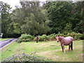
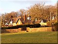
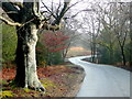
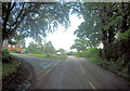
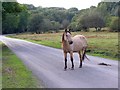
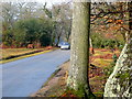


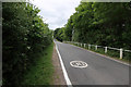
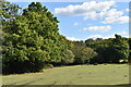
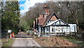
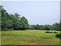
44 photos from this area
Area Information
Key information about the SO43 7JE including its size, population, and administrative classification.
- Area Type
- Postcode
- Area Size
- 56.7 hectares
- Population
- 1316
- Population Density
- 20 people/km²
House Prices in SO43 7JE
23
Properties
£669,722
Average Sold Price
£225,000
Lowest Price
£860,000
Highest Price
Showing 23 properties
| Address | Type | Beds | Baths | Last Sale Price | Last Sale Date | |
|---|---|---|---|---|---|---|
| Old Walters Cottage, Lyndhurst Road, Bramshaw, SO43 7JE | house | - | - | £860,000 | Sep 2020 | |
| Ryans Cottage, Vice Lane, Bramshaw, SO43 7JE | Detached | 4 | 2 | £860,000 | Sep 2019 | |
| Rowhill Cottage, Row Hill, Bramshaw, SO43 7JE | Cottage | 3 | 2 | £625,000 | Aug 2019 | |
| Holdfast Cottage, Row Hill, Bramshaw, SO43 7JE | Detached | 4 | 1 | £750,000 | Aug 2018 | |
| Consort Cottage, Row Hill, Bramshaw, SO43 7JE | house | - | - | £860,000 | Aug 2017 | |
| The Paddock, Lyndhurst Road, Bramshaw, SO43 7JE | Detached | 4 | - | £710,000 | Jan 2016 | |
| The Barn, Lyndhurst Road, Bramshaw, SO43 7JE | Detached | - | - | £735,000 | Sep 2007 | |
| Hollybank Cottage, Row Hill, Bramshaw, SO43 7JE | Detached | - | - | £402,500 | Oct 1999 | |
| Ryans Farm, Ryans Farmhouse, Vice Lane, Bramshaw, SO43 7JE | house | - | - | £225,000 | Sep 1996 | |
| Petina, Row Hill, Bramshaw, SO43 7JE | Detached | 3 | 1 | - | - |
Page 1 of 3
Energy Efficiency in SO43 7JE
Amenities
Schools
| Rank | School | Type | Entry gender | Ages |
|---|
Explore more schools in this area
Go to Schools tabDemographics
Household Size
Two person
most common
Accommodation Type
Houses
most common
Tenure
79
majority
Ethnic Group
White
most common
Religion
N/A
most common
Household Composition
N/A
most common
Age
47
median
Adults (30-64 years)
most common
Household Deprivation
N/A
with no deprivation
NS-SEC
45
in Lower managerial occupations
Explore more demographic insights in this area
Go to Demographics tabPlanning
Planning Constraints
- Flood RiskPremium
- Ramsar Wetland SitesPremium
- Area of Outstanding Natural BeautyPremium
- Protected Nature ReservePremium
- Protected WoodlandPremium