Area Overview for SO41 6FR
Photos of SO41 6FR
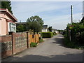
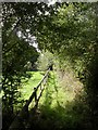
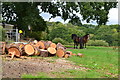
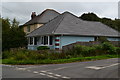
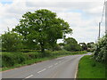
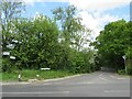
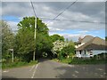
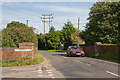
34 photos from this area
Area Information
Key information about the SO41 6FR including its size, population, and administrative classification.
- Area Type
- Postcode
- Area Size
- 16.6 hectares
- Population
- 2114
- Population Density
- 143 people/km²
House Prices in SO41 6FR
14
Properties
£520,625
Average Sold Price
£222,500
Lowest Price
£750,000
Highest Price
Showing 14 properties
| Address | Type | Beds | Baths | Last Sale Price | Last Sale Date | |
|---|---|---|---|---|---|---|
| The Borders, Sway Road, Tiptoe, SO41 6FR | Detached | 3 | 1 | £750,000 | Feb 2021 | |
| Burleigh, Sway Road, Tiptoe, SO41 6FR | Detached | 5 | 3 | £560,000 | Feb 2017 | |
| Puddles, Sway Road, Tiptoe, SO41 6FR | Bungalow | 3 | - | £550,000 | Aug 2014 | |
| Tiptoe Cross, Sway Road, Tiptoe, SO41 6FR | Detached | 3 | 2 | £222,500 | Mar 1998 | |
| Fuchsia Farm, Sway Road, Tiptoe, SO41 6FR | Equestrian | 3 | 2 | - | - | |
| Tiptoe Butterflies Pre School, Church Hall, St Andrews Church, Sway Road, Tiptoe, SO41 6FR | commercial | - | - | - | - | |
| Folium Flos Plants, Meadow Farm, Sway Road, Tiptoe, SO41 6FR | commercial | - | - | - | - | |
| Hinton And Brockhill Nurseries, Sway Road, Tiptoe, SO41 6FR | house | - | - | - | - | |
| Gregory, Sway Road, Tiptoe, SO41 6FR | Detached | - | - | - | - | |
| Oaklea, Sway Road, Tiptoe, SO41 6FR | Detached | - | - | - | - |
Page 1 of 2
Energy Efficiency in SO41 6FR
Amenities
Schools
| Rank | School | Type | Entry gender | Ages |
|---|
Explore more schools in this area
Go to Schools tabDemographics
Household Size
Two person
most common
Accommodation Type
Houses
most common
Tenure
87
majority
Ethnic Group
White
most common
Religion
N/A
most common
Household Composition
N/A
most common
Age
47
median
Adults (30-64 years)
most common
Household Deprivation
N/A
with no deprivation
NS-SEC
44
in Lower managerial occupations
Explore more demographic insights in this area
Go to Demographics tabPlanning
Planning Constraints
- Flood RiskPremium
- Ramsar Wetland SitesPremium
- Area of Outstanding Natural BeautyPremium
- Protected Nature ReservePremium
- Protected WoodlandPremium