Area Overview for SO30 3EY
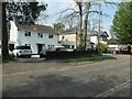
Photos of SO30 3EY


![Thornhill Park Road [A334] in SO30 3EY](https://images.propbar.co.uk/images/geograph/71/75/7175833_120.jpg)
28 photos from this area
Area Information
Key information about the SO30 3EY including its size, population, and administrative classification.
- Area Type
- Postcode
- Area Size
- 9308 m²
- Population
- 1563
- Population Density
- 963 people/km²
House Prices in SO30 3EY
13
Properties
£486,143
Average Sold Price
£207,000
Lowest Price
£775,000
Highest Price
Showing 13 properties
| Address | Type | Beds | Baths | Last Sale Price | Last Sale Date | |
|---|---|---|---|---|---|---|
| 68 Telegraph Road, West End, SO30 3EY | Retail | 4 | 3 | £690,000 | Nov 2024 | |
| 82 Telegraph Road, West End, SO30 3EY | Bungalow | 6 | 3 | £655,000 | Jul 2024 | |
| 74 Telegraph Road, West End, SO30 3EY | Bungalow | - | - | £520,000 | Feb 2023 | |
| 60 Telegraph Road, West End, SO30 3EY | house | - | - | £775,000 | Jan 2022 | |
| 72 Telegraph Road, West End, SO30 3EY | Bungalow | - | - | £266,000 | Apr 2013 | |
| 62 Telegraph Road, West End, SO30 3EY | Bungalow | 4 | 2 | £290,000 | Jul 2010 | |
| 78 Telegraph Road, West End, SO30 3EY | Detached | - | - | £207,000 | Jul 2002 | |
| 84 Telegraph Road, West End, SO30 3EY | Detached | - | - | - | - | |
| 80 Telegraph Road, West End, SO30 3EY | Detached | - | - | - | - | |
| 66 Telegraph Road, West End, SO30 3EY | Detached | - | - | - | - |
Page 1 of 2
Energy Efficiency in SO30 3EY
Amenities
Schools
| Rank | School | Type | Entry gender | Ages |
|---|
Explore more schools in this area
Go to Schools tabDemographics
Household Size
Two person
most common
Accommodation Type
Houses
most common
Tenure
85
majority
Ethnic Group
White
most common
Religion
N/A
most common
Household Composition
N/A
most common
Age
47
median
Adults (30-64 years)
most common
Household Deprivation
N/A
with no deprivation
NS-SEC
41
in Lower managerial occupations
Explore more demographic insights in this area
Go to Demographics tabPlanning
Planning Constraints
- Flood RiskPremium
- Ramsar Wetland SitesPremium
- Area of Outstanding Natural BeautyPremium
- Protected Nature ReservePremium
- Protected WoodlandPremium