Area Overview for SO30 3EH
Photos of SO30 3EH


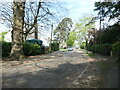
![Thornhill Park Road [A334] in SO30 3EH](https://images.propbar.co.uk/images/geograph/71/75/7175833_120.jpg)
28 photos from this area
Area Information
Key information about the SO30 3EH including its size, population, and administrative classification.
- Area Type
- Postcode
- Area Size
- 8.4 hectares
- Population
- 1563
- Population Density
- 963 people/km²
House Prices in SO30 3EH
17
Properties
£750,000
Average Sold Price
£750,000
Lowest Price
£750,000
Highest Price
Showing 17 properties
| Address | Type | Beds | Baths | Last Sale Price | Last Sale Date | |
|---|---|---|---|---|---|---|
| Meadow Lodge, Telegraph Road, West End, SO30 3EH | Detached | 5 | 2 | £750,000 | Mar 2025 | |
| Flat 7, Kenilworth House, 3 Telegraph Road, West End, SO30 3EH | Detached | 3 | 1 | - | - | |
| 7 Telegraph Road, West End, SO30 3EH | Retail | 4 | 4 | - | - | |
| Flat 11, Kenilworth House, 3 Telegraph Road, West End, SO30 3EH | Flat | 1 | - | - | - | |
| Flat 1, Kenilworth House, 3 Telegraph Road, West End, SO30 3EH | Flat | 3 | 2 | - | - | |
| The Annexe, Meadow Lodge, Telegraph Road, West End, SO30 3EH | undefined | - | - | - | - | |
| Wood Gate, Telegraph Road, West End, SO30 3EH | undefined | - | - | - | - | |
| 1 Telegraph Road, West End, SO30 3EH | undefined | - | - | - | - | |
| Flat 12, Kenilworth House, 3 Telegraph Road, West End, SO30 3EH | Flat | - | - | - | - | |
| Flat 2, Kenilworth House, 3 Telegraph Road, West End, SO30 3EH | Flat | - | - | - | - |
Page 1 of 2
Energy Efficiency in SO30 3EH
Amenities
Schools
| Rank | School | Type | Entry gender | Ages |
|---|
Explore more schools in this area
Go to Schools tabDemographics
Household Size
Two person
most common
Accommodation Type
Houses
most common
Tenure
85
majority
Ethnic Group
White
most common
Religion
N/A
most common
Household Composition
N/A
most common
Age
47
median
Adults (30-64 years)
most common
Household Deprivation
N/A
with no deprivation
NS-SEC
41
in Lower managerial occupations
Explore more demographic insights in this area
Go to Demographics tabPlanning
Planning Constraints
- Flood RiskPremium
- Ramsar Wetland SitesPremium
- Area of Outstanding Natural BeautyPremium
- Protected Nature ReservePremium
- Protected WoodlandPremium