Area Overview for SO30 0GN
Photos of SO30 0GN
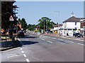
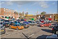
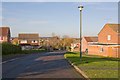
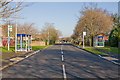
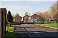
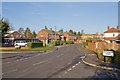
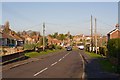
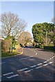
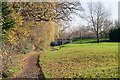
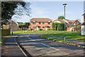
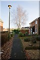
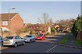
47 photos from this area
Area Information
Key information about the SO30 0GN including its size, population, and administrative classification.
- Area Type
- Postcode
- Area Size
- 8406 m²
- Population
- 1500
- Population Density
- 4825 people/km²
House Prices in SO30 0GN
17
Properties
£273,674
Average Sold Price
£113,500
Lowest Price
£415,000
Highest Price
Showing 17 properties
| Address | Type | Beds | Baths | Last Sale Price | Last Sale Date | |
|---|---|---|---|---|---|---|
| 19 Mapleton Road, Hedge End, SO30 0GN | Bungalow | - | - | £379,500 | Apr 2022 | |
| 5 Mapleton Road, Hedge End, SO30 0GN | house | - | - | £354,760 | Jul 2021 | |
| 7 Mapleton Road, Hedge End, SO30 0GN | Bungalow | - | - | £415,000 | Sep 2019 | |
| 27 Mapleton Road, Hedge End, SO30 0GN | Semi-detached | 3 | 1 | £288,500 | Jul 2019 | |
| Whitecroft, 3 Mapleton Road, Hedge End, SO30 0GN | Bungalow | - | - | £307,000 | Jul 2019 | |
| Eastcroft, 21 Mapleton Road, Hedge End, SO30 0GN | Bungalow | 3 | 2 | £400,000 | Mar 2019 | |
| Runswick, 23 Mapleton Road, Hedge End, SO30 0GN | Bungalow | 4 | 2 | £330,000 | Jan 2018 | |
| 31 Mapleton Road, Hedge End, SO30 0GN | Semi-detached | 4 | - | £274,000 | Feb 2016 | |
| 1 Mapleton Road, Hedge End, SO30 0GN | Bungalow | - | - | £226,500 | Jun 2011 | |
| 11 Mapleton Road, Hedge End, SO30 0GN | Bungalow | - | - | £220,000 | Feb 2010 |
Page 1 of 2
Energy Efficiency in SO30 0GN
Amenities
Schools
| Rank | School | Type | Entry gender | Ages |
|---|
Explore more schools in this area
Go to Schools tabDemographics
Household Size
Two person
most common
Accommodation Type
Houses
most common
Tenure
93
majority
Ethnic Group
White
most common
Religion
N/A
most common
Household Composition
N/A
most common
Age
47
median
Adults (30-64 years)
most common
Household Deprivation
N/A
with no deprivation
NS-SEC
37
in Lower managerial occupations
Explore more demographic insights in this area
Go to Demographics tabPlanning
Planning Constraints
- Flood RiskPremium
- Ramsar Wetland SitesPremium
- Area of Outstanding Natural BeautyPremium
- Protected Nature ReservePremium
- Protected WoodlandPremium