Area Overview for SO22 5AE
Photos of SO22 5AE
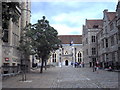
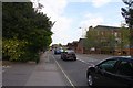
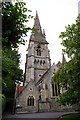
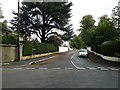

100 photos from this area
Area Information
Key information about the SO22 5AE including its size, population, and administrative classification.
- Area Type
- Postcode
- Area Size
- 1915 m²
- Population
- 1222
- Population Density
- 4744 people/km²
House Prices in SO22 5AE
7
Properties
£184,000
Average Sold Price
£48,500
Lowest Price
£480,000
Highest Price
Showing 7 properties
| Address | Type | Beds | Baths | Last Sale Price | Last Sale Date | |
|---|---|---|---|---|---|---|
| 13 St Pauls Hill, Winchester, SO22 5AE | Flat | - | - | £48,500 | May 2024 | |
| 19 St Pauls Hill, Winchester, SO22 5AE | Detached | 4 | 1 | £480,000 | Jul 2015 | |
| 15 St Pauls Hill, Winchester, SO22 5AE | Maisonette | 1 | 1 | £90,000 | Nov 2001 | |
| 17 St Pauls Hill, Winchester, SO22 5AE | Semi-detached | 1 | 1 | £117,500 | Sep 2001 | |
| The Flat, Railway Inn, 3 St Pauls Hill, Winchester, SO22 5AE | Flat | - | - | - | - | |
| Railway Inn, 3 St Pauls Hill, Winchester, SO22 5AE | restaurant_cafe | - | - | - | - | |
| Gardenhurst, St Pauls Hill, Winchester, SO22 5AE | Detached | - | - | - | - |
Energy Efficiency in SO22 5AE
Amenities
Schools
| Rank | School | Type | Entry gender | Ages |
|---|
Explore more schools in this area
Go to Schools tabDemographics
Household Size
Family (3-5 people)
most common
Accommodation Type
Houses
most common
Tenure
74
majority
Ethnic Group
White
most common
Religion
N/A
most common
Household Composition
N/A
most common
Age
47
median
Adults (30-64 years)
most common
Household Deprivation
N/A
with no deprivation
NS-SEC
60
in Lower managerial occupations
Explore more demographic insights in this area
Go to Demographics tabPlanning
Planning Constraints
- Flood RiskPremium
- Ramsar Wetland SitesPremium
- Area of Outstanding Natural BeautyPremium
- Protected Nature ReservePremium
- Protected WoodlandPremium