Area Overview for SO22 6RN
Photos of SO22 6RN

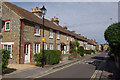

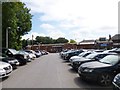

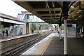
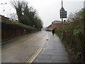
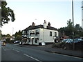
95 photos from this area
Area Information
Key information about the SO22 6RN including its size, population, and administrative classification.
- Area Type
- Postcode
- Area Size
- 8848 m²
- Population
- 1222
- Population Density
- 4744 people/km²
House Prices in SO22 6RN
55
Properties
£427,978
Average Sold Price
£76,500
Lowest Price
£740,000
Highest Price
Showing 55 properties
| Address | Type | Beds | Baths | Last Sale Price | Last Sale Date | |
|---|---|---|---|---|---|---|
| 6, Becks Mews, 108 Stockbridge Road, Winchester, SO22 6RN | Terraced | 2 | 2 | £474,000 | Aug 2025 | |
| 138 Stockbridge Road, Winchester, SO22 6RN | Detached | 2 | 1 | £535,000 | Mar 2025 | |
| 150 Stockbridge Road, Winchester, SO22 6RN | Terraced | 2 | 2 | £675,000 | Jun 2024 | |
| 158 Stockbridge Road, Winchester, SO22 6RN | Terraced | 2 | 3 | £405,000 | Apr 2024 | |
| 1, Becks Mews, 108 Stockbridge Road, Winchester, SO22 6RN | Detached | 5 | 4 | £740,000 | Mar 2024 | |
| 156 Stockbridge Road, Winchester, SO22 6RN | Terraced | 3 | 1 | £470,000 | Dec 2022 | |
| 154 Stockbridge Road, Winchester, SO22 6RN | Terraced | 3 | 2 | £630,000 | Dec 2022 | |
| 132A Stockbridge Road, Winchester, SO22 6RN | Flat | - | - | £545,000 | Nov 2022 | |
| 130 Stockbridge Road, Winchester, SO22 6RN | Terraced | 2 | 1 | £410,500 | Sep 2021 | |
| 17A Stockbridge Road, Winchester, SO22 6RN | Maisonette | - | - | £315,000 | Mar 2021 |
Page 1 of 6
Energy Efficiency in SO22 6RN
Amenities
Schools
| Rank | School | Type | Entry gender | Ages |
|---|
Explore more schools in this area
Go to Schools tabDemographics
Household Size
Family (3-5 people)
most common
Accommodation Type
Houses
most common
Tenure
74
majority
Ethnic Group
White
most common
Religion
N/A
most common
Household Composition
N/A
most common
Age
47
median
Adults (30-64 years)
most common
Household Deprivation
N/A
with no deprivation
NS-SEC
60
in Lower managerial occupations
Explore more demographic insights in this area
Go to Demographics tabPlanning
Planning Constraints
- Flood RiskPremium
- Ramsar Wetland SitesPremium
- Area of Outstanding Natural BeautyPremium
- Protected Nature ReservePremium
- Protected WoodlandPremium