Area Overview for SO21 2NN
Photos of SO21 2NN

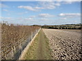
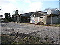
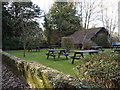
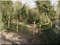
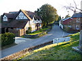

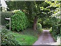
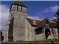
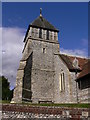
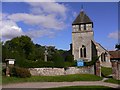

102 photos from this area
Area Information
Key information about the SO21 2NN including its size, population, and administrative classification.
- Area Type
- Postcode
- Area Size
- 5.2 hectares
- Population
- 2665
- Population Density
- 73 people/km²
House Prices in SO21 2NN
14
Properties
£995,100
Average Sold Price
£235,000
Lowest Price
£1,900,000
Highest Price
Showing 14 properties
| Address | Type | Beds | Baths | Last Sale Price | Last Sale Date | |
|---|---|---|---|---|---|---|
| Little Mead, Home Lane, Sparsholt, SO21 2NN | house | - | - | £1,750,000 | Jan 2024 | |
| Woodbine House, Home Lane, Sparsholt, SO21 2NN | Detached | 5 | 3 | £1,900,000 | May 2023 | |
| Christmas Cottage, Home Lane, Sparsholt, SO21 2NN | house | - | - | £950,000 | Jun 2021 | |
| Home Lane Cottage, Home Lane, Sparsholt, SO21 2NN | house | - | - | £1,150,000 | Apr 2019 | |
| The Lodge, Home Lane, Sparsholt, SO21 2NN | Detached | 4 | - | £1,425,000 | Aug 2017 | |
| Pies Cottage, Home Lane, Sparsholt, SO21 2NN | house | - | - | £1,301,000 | Aug 2009 | |
| Mistletoe Cottage, Home Lane, Sparsholt, SO21 2NN | Bungalow | - | - | £400,000 | Aug 2009 | |
| Ashridge, Home Lane, Sparsholt, SO21 2NN | Detached | 4 | - | £425,000 | Feb 2001 | |
| Mayfield House, Home Lane, Sparsholt, SO21 2NN | Detached | - | - | £415,000 | Dec 1995 | |
| Ashcombe House, Home Lane, Sparsholt, SO21 2NN | Detached | - | - | £235,000 | Feb 1995 |
Page 1 of 2
Energy Efficiency in SO21 2NN
Amenities
Schools
| Rank | School | Type | Entry gender | Ages |
|---|
Explore more schools in this area
Go to Schools tabDemographics
Household Size
Family (3-5 people)
most common
Accommodation Type
Houses
most common
Tenure
73
majority
Ethnic Group
White
most common
Religion
N/A
most common
Household Composition
N/A
most common
Age
47
median
Adults (30-64 years)
most common
Household Deprivation
N/A
with no deprivation
NS-SEC
49
in Lower managerial occupations
Explore more demographic insights in this area
Go to Demographics tabPlanning
Planning Constraints
- Flood RiskPremium
- Ramsar Wetland SitesPremium
- Area of Outstanding Natural BeautyPremium
- Protected Nature ReservePremium
- Protected WoodlandPremium