Area Overview for SO21 2NJ
Photos of SO21 2NJ
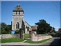
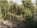
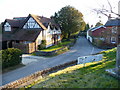
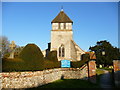
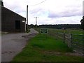
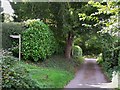
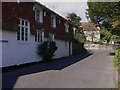
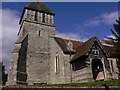
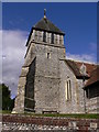
100 photos from this area
Area Information
Key information about the SO21 2NJ including its size, population, and administrative classification.
- Area Type
- Postcode
- Area Size
- 11.0 hectares
- Population
- 2665
- Population Density
- 73 people/km²
House Prices in SO21 2NJ
21
Properties
£1,219,625
Average Sold Price
£245,000
Lowest Price
£1,975,000
Highest Price
Showing 21 properties
| Address | Type | Beds | Baths | Last Sale Price | Last Sale Date | |
|---|---|---|---|---|---|---|
| Clareholme, Church Lane, Sparsholt, SO21 2NJ | Detached | 5 | 2 | £945,000 | Aug 2019 | |
| Phoenix House, Church Lane, Sparsholt, SO21 2NJ | house | - | - | £1,975,000 | Aug 2017 | |
| Wheathill, Church Lane, Sparsholt, SO21 2NJ | house | 3 | - | £1,750,000 | Aug 2010 | |
| Woodrows, Church Lane, Sparsholt, SO21 2NJ | Detached | 6 | 4 | £1,640,000 | Jul 2006 | |
| Wood Cottage, Church Lane, Sparsholt, SO21 2NJ | Cottage | 4 | - | £650,000 | Jan 2006 | |
| The White House, Church Lane, Sparsholt, SO21 2NJ | Detached | - | - | £1,402,000 | Aug 2004 | |
| Hillcrest, Church Lane, Sparsholt, SO21 2NJ | house | 5 | - | £1,150,000 | Jun 1999 | |
| Upcott Cottage, Church Lane, Sparsholt, SO21 2NJ | Detached | - | - | £245,000 | Oct 1998 | |
| Mountview, Church Lane, Sparsholt, SO21 2NJ | Detached | 5 | 2 | - | - | |
| The Thatched House, Church Lane, Sparsholt, SO21 2NJ | house | 5 | - | - | - |
Page 1 of 3
Energy Efficiency in SO21 2NJ
Amenities
Schools
| Rank | School | Type | Entry gender | Ages |
|---|
Explore more schools in this area
Go to Schools tabDemographics
Household Size
Family (3-5 people)
most common
Accommodation Type
Houses
most common
Tenure
73
majority
Ethnic Group
White
most common
Religion
N/A
most common
Household Composition
N/A
most common
Age
47
median
Adults (30-64 years)
most common
Household Deprivation
N/A
with no deprivation
NS-SEC
49
in Lower managerial occupations
Explore more demographic insights in this area
Go to Demographics tabPlanning
Planning Constraints
- Flood RiskPremium
- Ramsar Wetland SitesPremium
- Area of Outstanding Natural BeautyPremium
- Protected Nature ReservePremium
- Protected WoodlandPremium