Area Overview for SO21 1GB
Photos of SO21 1GB
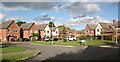
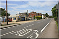
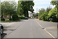
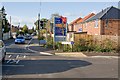
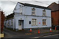
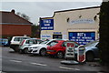
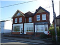
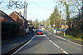
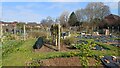

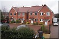
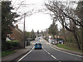
25 photos from this area
Area Information
Key information about the SO21 1GB including its size, population, and administrative classification.
- Area Type
- Postcode
- Area Size
- 5.5 hectares
- Population
- 2279
- Population Density
- 813 people/km²
House Prices in SO21 1GB
62
Properties
£363,743
Average Sold Price
£289,995
Lowest Price
£535,000
Highest Price
Showing 62 properties
| Address | Type | Beds | Baths | Last Sale Price | Last Sale Date | |
|---|---|---|---|---|---|---|
| 46 Badgers Bolt, Colden Common, SO21 1GB | Semi-detached | 3 | 2 | £372,500 | Nov 2025 | |
| 19 Badgers Bolt, Colden Common, SO21 1GB | Detached | 3 | 2 | £363,000 | Nov 2025 | |
| 59 Badgers Bolt, Colden Common, SO21 1GB | Semi-detached | 3 | 2 | £440,000 | Oct 2025 | |
| 20 Badgers Bolt, Colden Common, SO21 1GB | Detached | 3 | 2 | £440,000 | Aug 2025 | |
| 8 Badgers Bolt, Colden Common, SO21 1GB | Semi-detached | 3 | 2 | £348,500 | Mar 2025 | |
| 35 Badgers Bolt, Colden Common, SO21 1GB | Semi-detached | 3 | 2 | £395,000 | Dec 2024 | |
| 34 Badgers Bolt, Colden Common, SO21 1GB | house | - | - | £415,000 | Oct 2024 | |
| 42 Badgers Bolt, Colden Common, SO21 1GB | house | - | - | £535,000 | Jan 2024 | |
| 14 Badgers Bolt, Colden Common, SO21 1GB | Detached | 4 | 2 | £535,000 | Dec 2023 | |
| 10 Badgers Bolt, Colden Common, SO21 1GB | Semi-detached | 3 | 2 | £415,000 | Mar 2023 |
Page 1 of 7
Energy Efficiency in SO21 1GB
Amenities
Schools
| Rank | School | Type | Entry gender | Ages |
|---|
Explore more schools in this area
Go to Schools tabDemographics
Household Size
Two person
most common
Accommodation Type
Houses
most common
Tenure
88
majority
Ethnic Group
White
most common
Religion
N/A
most common
Household Composition
N/A
most common
Age
47
median
Adults (30-64 years)
most common
Household Deprivation
N/A
with no deprivation
NS-SEC
50
in Lower managerial occupations
Explore more demographic insights in this area
Go to Demographics tabPlanning
Planning Constraints
- Flood RiskPremium
- Ramsar Wetland SitesPremium
- Area of Outstanding Natural BeautyPremium
- Protected Nature ReservePremium
- Protected WoodlandPremium