Area Overview for SO21 1DE
Photos of SO21 1DE

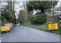
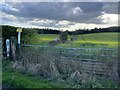
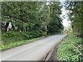
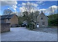
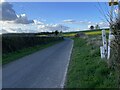
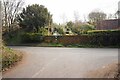
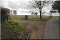
22 photos from this area
Area Information
Key information about the SO21 1DE including its size, population, and administrative classification.
- Area Type
- Postcode
- Area Size
- 53.1 hectares
- Population
- 2019
- Population Density
- 28 people/km²
House Prices in SO21 1DE
18
Properties
£1,004,813
Average Sold Price
£230,000
Lowest Price
£1,900,000
Highest Price
Showing 18 properties
| Address | Type | Beds | Baths | Last Sale Price | Last Sale Date | |
|---|---|---|---|---|---|---|
| The Cedar House, Avington Road, Avington, SO21 1DE | Detached | 5 | 4 | £1,782,500 | Dec 2024 | |
| West Hill Farmhouse, Avington Road, Avington, SO21 1DE | house | - | - | £1,306,000 | Sep 2021 | |
| Pipits Hill, Avington Road, Avington, SO21 1DE | Detached | 7 | - | £1,900,000 | Sep 2019 | |
| The Old Dairy, Avington Road, Avington, SO21 1DE | Terraced | 3 | - | £640,000 | Aug 2015 | |
| Old School House, Avington Road, Avington, SO21 1DE | Detached | 3 | - | £640,000 | Feb 2015 | |
| West Hill Dairy, Avington Road, Avington, SO21 1DE | house | 3 | - | £775,000 | Jul 2014 | |
| Longbow, Avington Road, Avington, SO21 1DE | Detached | 4 | 2 | £765,000 | May 2012 | |
| West Hill Barn, Avington Road, Avington, SO21 1DE | house | - | - | £230,000 | Dec 1997 | |
| 6, The Row, Avington Road, Avington, SO21 1DE | Terraced | 2 | 1 | - | - | |
| 7, The Row, Avington Road, Avington, SO21 1DE | Terraced | 2 | - | - | - |
Page 1 of 2
Energy Efficiency in SO21 1DE
Amenities
Schools
| Rank | School | Type | Entry gender | Ages |
|---|
Explore more schools in this area
Go to Schools tabDemographics
Household Size
Two person
most common
Accommodation Type
Houses
most common
Tenure
71
majority
Ethnic Group
White
most common
Religion
N/A
most common
Household Composition
N/A
most common
Age
47
median
Adults (30-64 years)
most common
Household Deprivation
N/A
with no deprivation
NS-SEC
49
in Lower managerial occupations
Explore more demographic insights in this area
Go to Demographics tabPlanning
Planning Constraints
- Flood RiskPremium
- Ramsar Wetland SitesPremium
- Area of Outstanding Natural BeautyPremium
- Protected Nature ReservePremium
- Protected WoodlandPremium