Area Overview for SO21 1DD
Photos of SO21 1DD
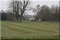
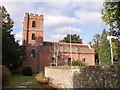
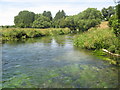
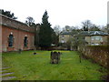
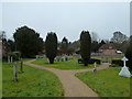
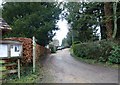
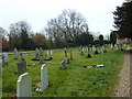
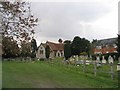
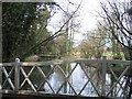
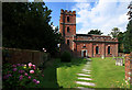
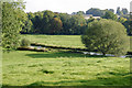
100 photos from this area
Area Information
Key information about the SO21 1DD including its size, population, and administrative classification.
- Area Type
- Postcode
- Area Size
- 23.0 hectares
- Population
- 2019
- Population Density
- 28 people/km²
House Prices in SO21 1DD
20
Properties
£2,900,375
Average Sold Price
£70,000
Lowest Price
£16,000,000
Highest Price
Showing 20 properties
| Address | Type | Beds | Baths | Last Sale Price | Last Sale Date | |
|---|---|---|---|---|---|---|
| Yew Tree Cottage, Avington Road, Avington, SO21 1DD | Detached | - | - | £1,005,000 | Oct 2021 | |
| East Tennyson Flat, Avington Park, Avington, SO21 1DD | Flat | 7 | - | £16,000,000 | Nov 2020 | |
| Woodside, Avington Road, Avington, SO21 1DD | house | 6 | - | £1,700,000 | Oct 2016 | |
| Coachmans Cottage, Avington Road, Avington, SO21 1DD | Bungalow | - | - | £2,500,000 | Dec 2011 | |
| The Old Rectory, Avington Road, Avington, SO21 1DD | Bungalow | - | - | £1,580,000 | Apr 2006 | |
| The Cottage, Avington Road, Avington, SO21 1DD | Cottage | 3 | 1 | £70,000 | Jan 1999 | |
| 2, New Cottages, Avington Road, Avington, SO21 1DD | Semi-detached | - | - | £88,000 | Jan 1999 | |
| Hedgerows, Avington Road, Avington, SO21 1DD | Detached | - | - | £260,000 | Jul 1998 | |
| 1, Shilling Cottage, Chandos Terrace, Avington Road, Avington, SO21 1DD | Detached | 3 | 2 | - | - | |
| 1, Nevasa, New Cottages, Avington Road, Avington, SO21 1DD | Semi-detached | 3 | 1 | - | - |
Page 1 of 2
Energy Efficiency in SO21 1DD
Amenities
Schools
| Rank | School | Type | Entry gender | Ages |
|---|
Explore more schools in this area
Go to Schools tabDemographics
Household Size
Two person
most common
Accommodation Type
Houses
most common
Tenure
71
majority
Ethnic Group
White
most common
Religion
N/A
most common
Household Composition
N/A
most common
Age
47
median
Adults (30-64 years)
most common
Household Deprivation
N/A
with no deprivation
NS-SEC
49
in Lower managerial occupations
Explore more demographic insights in this area
Go to Demographics tabPlanning
Planning Constraints
- Flood RiskPremium
- Ramsar Wetland SitesPremium
- Area of Outstanding Natural BeautyPremium
- Protected Nature ReservePremium
- Protected WoodlandPremium