Area Overview for SO20 8HE
Photos of SO20 8HE
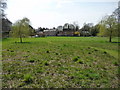

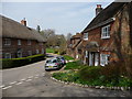
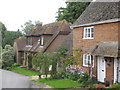
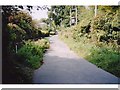

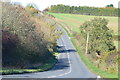


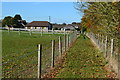
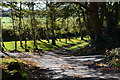
33 photos from this area
Area Information
Key information about the SO20 8HE including its size, population, and administrative classification.
- Area Type
- Postcode
- Area Size
- 33.6 hectares
- Population
- 1556
- Population Density
- 37 people/km²
House Prices in SO20 8HE
13
Properties
£1,301,667
Average Sold Price
£250,000
Lowest Price
£2,375,000
Highest Price
Showing 13 properties
| Address | Type | Beds | Baths | Last Sale Price | Last Sale Date | |
|---|---|---|---|---|---|---|
| Monks, Ducks Lane, Nether Wallop, SO20 8HE | Detached | - | - | £2,000,000 | Aug 2022 | |
| 2, Ducks Cottages, Ducks Lane, Nether Wallop, SO20 8HE | Detached | 3 | 2 | £545,000 | Oct 2019 | |
| Chalkwell, Hosketts Lane, Nether Wallop, SO20 8HE | house | - | - | £2,375,000 | Jun 2014 | |
| Wallop House, Ducks Lane, Nether Wallop, SO20 8HE | Detached | 5 | 3 | £2,350,000 | Nov 2013 | |
| 1, Ducks Cottages, Ducks Lane, Nether Wallop, SO20 8HE | Semi-detached | - | - | £290,000 | May 2005 | |
| York Lodge, Five Bells Lane, Nether Wallop, SO20 8HE | Bungalow | 1 | 1 | £250,000 | Aug 1999 | |
| COACH HOUSE, WINTON HOUSE, FARLEY STREET, Nether Wallop, SO20 8HE | Detached | 2 | - | - | - | |
| The Lodge, Wallop House, Farley Street, Nether Wallop, SO20 8HE | undefined | - | - | - | - | |
| Flat 1 Winton Nursing Home, Winton House, Farley Street, Nether Wallop, SO20 8HE | Flat | - | - | - | - | |
| Flat 2 Winton Nursing Home, Winton House, Farley Street, Nether Wallop, SO20 8HE | Flat | - | - | - | - |
Page 1 of 2
Energy Efficiency in SO20 8HE
Amenities
Schools
| Rank | School | Type | Entry gender | Ages |
|---|
Explore more schools in this area
Go to Schools tabDemographics
Household Size
Two person
most common
Accommodation Type
Houses
most common
Tenure
69
majority
Ethnic Group
White
most common
Religion
N/A
most common
Household Composition
N/A
most common
Age
47
median
Adults (30-64 years)
most common
Household Deprivation
N/A
with no deprivation
NS-SEC
44
in Lower managerial occupations
Explore more demographic insights in this area
Go to Demographics tabPlanning
Planning Constraints
- Flood RiskPremium
- Ramsar Wetland SitesPremium
- Area of Outstanding Natural BeautyPremium
- Protected Nature ReservePremium
- Protected WoodlandPremium