Area Overview for SO20 8EJ
Photos of SO20 8EJ
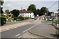
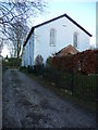
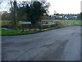
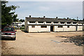
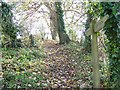
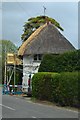

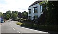
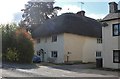
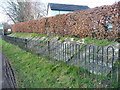
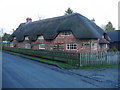
26 photos from this area
Area Information
Key information about the SO20 8EJ including its size, population, and administrative classification.
- Area Type
- Postcode
- Area Size
- 25.4 hectares
- Population
- 1556
- Population Density
- 37 people/km²
House Prices in SO20 8EJ
14
Properties
£678,000
Average Sold Price
£90,000
Lowest Price
£1,120,000
Highest Price
Showing 14 properties
| Address | Type | Beds | Baths | Last Sale Price | Last Sale Date | |
|---|---|---|---|---|---|---|
| Old Farm House, Bent Street, Nether Wallop, SO20 8EJ | Detached | - | - | £460,000 | Feb 2021 | |
| Cherry Tree Cottage, Bent Street, Nether Wallop, SO20 8EJ | house | - | - | £936,000 | Apr 2020 | |
| Honey Cottage, Bent Street, Nether Wallop, SO20 8EJ | Detached | - | - | £1,120,000 | Feb 2019 | |
| Splinters, Bent Street, Nether Wallop, SO20 8EJ | Detached | - | - | £775,000 | Jul 2017 | |
| Goddards Barn, Bent Street, Nether Wallop, SO20 8EJ | house | - | - | £880,000 | Sep 2009 | |
| The Old Cottage, Bent Street, Nether Wallop, SO20 8EJ | Detached | 5 | 3 | £485,000 | Apr 2002 | |
| Araucana, Bent Street, Nether Wallop, SO20 8EJ | Detached | 5 | - | £90,000 | Jul 1995 | |
| The Annexe, Araucana, Bent Street, Nether Wallop, SO20 8EJ | Detached | 5 | - | - | - | |
| Cordwainers Cottage, Bent Street, Nether Wallop, SO20 8EJ | Detached | - | - | - | - | |
| Hill Farm House, Bent Street, Nether Wallop, SO20 8EJ | Detached | - | - | - | - |
Page 1 of 2
Energy Efficiency in SO20 8EJ
Amenities
Schools
| Rank | School | Type | Entry gender | Ages |
|---|
Explore more schools in this area
Go to Schools tabDemographics
Household Size
Two person
most common
Accommodation Type
Houses
most common
Tenure
69
majority
Ethnic Group
White
most common
Religion
N/A
most common
Household Composition
N/A
most common
Age
47
median
Adults (30-64 years)
most common
Household Deprivation
N/A
with no deprivation
NS-SEC
44
in Lower managerial occupations
Explore more demographic insights in this area
Go to Demographics tabPlanning
Planning Constraints
- Flood RiskPremium
- Ramsar Wetland SitesPremium
- Area of Outstanding Natural BeautyPremium
- Protected Nature ReservePremium
- Protected WoodlandPremium