Area Overview for SO20 8DA
Photos of SO20 8DA
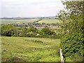

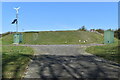
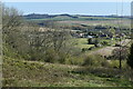
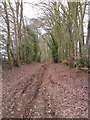
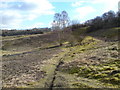
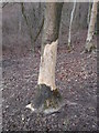
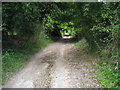
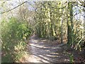

13 photos from this area
Area Information
Key information about the SO20 8DA including its size, population, and administrative classification.
- Area Type
- Postcode
- Area Size
- 2.5 km²
- Population
- 1583
- Population Density
- 49 people/km²
House Prices in SO20 8DA
13
Properties
£661,714
Average Sold Price
£330,000
Lowest Price
£917,000
Highest Price
Showing 13 properties
| Address | Type | Beds | Baths | Last Sale Price | Last Sale Date | |
|---|---|---|---|---|---|---|
| Sanctuary, Buckholt Road, Broughton, SO20 8DA | house | 3 | 2 | £760,000 | Jul 2024 | |
| 1 Buckholt Road, Broughton, SO20 8DA | Detached | 5 | 2 | £495,000 | Nov 2020 | |
| Tranquility, 2 Buckholt Road, Broughton, SO20 8DA | Detached | 4 | - | £480,000 | Oct 2015 | |
| Beechcroft, Buckholt Road, Broughton, SO20 8DA | house | - | - | £850,000 | Aug 2013 | |
| Queenwood Downs, Buckholt Road, Broughton, SO20 8DA | house | 5 | - | £917,000 | Oct 2012 | |
| Clarendon Cottage, Buckholt Road, Broughton, SO20 8DA | house | - | - | £330,000 | Apr 2010 | |
| Church Farm House, Buckholt Road, Broughton, SO20 8DA | Detached | - | - | £800,000 | Oct 2000 | |
| Amport Beeches, Buckholt Road, Broughton, SO20 8DA | Detached | 4 | 1 | - | - | |
| Hill House, Buckholt Road, Broughton, SO20 8DA | Detached | 7 | 5 | - | - | |
| Hill House Cottage, Buckholt Road, Broughton, SO20 8DA | Detached | - | - | - | - |
Page 1 of 2
Energy Efficiency in SO20 8DA
Amenities
Schools
| Rank | School | Type | Entry gender | Ages |
|---|
Explore more schools in this area
Go to Schools tabDemographics
Household Size
Two person
most common
Accommodation Type
Houses
most common
Tenure
73
majority
Ethnic Group
White
most common
Religion
N/A
most common
Household Composition
N/A
most common
Age
47
median
Adults (30-64 years)
most common
Household Deprivation
N/A
with no deprivation
NS-SEC
45
in Lower managerial occupations
Explore more demographic insights in this area
Go to Demographics tabPlanning
Planning Constraints
- Flood RiskPremium
- Ramsar Wetland SitesPremium
- Area of Outstanding Natural BeautyPremium
- Protected Nature ReservePremium
- Protected WoodlandPremium