Area Overview for SO19 9LX
Photos of SO19 9LX
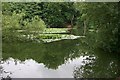
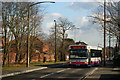
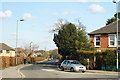
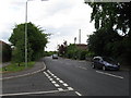

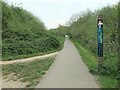
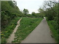
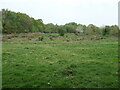
28 photos from this area
Area Information
Key information about the SO19 9LX including its size, population, and administrative classification.
- Area Type
- Postcode
- Area Size
- 2.6 hectares
- Population
- 1553
- Population Density
- 4258 people/km²
House Prices in SO19 9LX
29
Properties
£242,526
Average Sold Price
£102,000
Lowest Price
£462,000
Highest Price
Showing 29 properties
| Address | Type | Beds | Baths | Last Sale Price | Last Sale Date | |
|---|---|---|---|---|---|---|
| 36 The Grove, Southampton, SO19 9LX | Bungalow | 3 | 2 | £390,000 | Mar 2025 | |
| 40 The Grove, Southampton, SO19 9LX | Bungalow | 2 | 1 | £462,000 | Mar 2023 | |
| 18 The Grove, Southampton, SO19 9LX | house | 3 | - | £330,000 | Aug 2022 | |
| 16A The Grove, Southampton, SO19 9LX | Maisonette | 2 | 1 | £155,000 | Apr 2022 | |
| 16 The Grove, Southampton, SO19 9LX | Flat | 2 | 1 | £155,000 | Apr 2022 | |
| 54 The Grove, Southampton, SO19 9LX | Bungalow | 3 | 1 | £278,000 | Jul 2019 | |
| 58 The Grove, Southampton, SO19 9LX | Bungalow | - | - | £290,000 | Jul 2019 | |
| 18A The Grove, Southampton, SO19 9LX | Bungalow | 4 | 2 | £225,500 | Jun 2019 | |
| 14 The Grove, Southampton, SO19 9LX | Detached | 3 | - | £350,000 | Feb 2019 | |
| 56 The Grove, Southampton, SO19 9LX | Detached | 3 | 1 | £290,000 | May 2018 |
Page 1 of 3
Energy Efficiency in SO19 9LX
Amenities
Schools
| Rank | School | Type | Entry gender | Ages |
|---|
Explore more schools in this area
Go to Schools tabDemographics
Household Size
Family (3-5 people)
most common
Accommodation Type
Houses
most common
Tenure
61
majority
Ethnic Group
White
most common
Religion
N/A
most common
Household Composition
N/A
most common
Age
47
median
Adults (30-64 years)
most common
Household Deprivation
N/A
with no deprivation
NS-SEC
24
in Lower managerial occupations
Explore more demographic insights in this area
Go to Demographics tabPlanning
Planning Constraints
- Flood RiskPremium
- Ramsar Wetland SitesPremium
- Area of Outstanding Natural BeautyPremium
- Protected Nature ReservePremium
- Protected WoodlandPremium