Area Overview for SO19 9LU
Photos of SO19 9LU


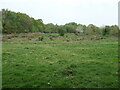
28 photos from this area
Area Information
Key information about the SO19 9LU including its size, population, and administrative classification.
- Area Type
- Postcode
- Area Size
- 4.3 hectares
- Population
- 1553
- Population Density
- 4258 people/km²
House Prices in SO19 9LU
68
Properties
£215,153
Average Sold Price
£66,000
Lowest Price
£327,000
Highest Price
Showing 68 properties
| Address | Type | Beds | Baths | Last Sale Price | Last Sale Date | |
|---|---|---|---|---|---|---|
| 146 The Grove, Southampton, SO19 9LU | Chalet | 4 | 2 | £325,000 | Jun 2025 | |
| 60 The Grove, Southampton, SO19 9LU | Semi-detached | 3 | 1 | £290,000 | Mar 2025 | |
| 122 The Grove, Southampton, SO19 9LU | Semi-detached | 3 | 2 | £308,000 | Oct 2023 | |
| 120 The Grove, Southampton, SO19 9LU | Semi-detached | 3 | 1 | £327,000 | Sep 2023 | |
| 124 The Grove, Southampton, SO19 9LU | Semi-detached | 2 | 1 | £310,000 | Mar 2023 | |
| 90 The Grove, Southampton, SO19 9LU | Semi-detached | 3 | 1 | £320,000 | May 2022 | |
| 64 The Grove, Southampton, SO19 9LU | house | 3 | 1 | £222,000 | Apr 2021 | |
| 114 The Grove, Southampton, SO19 9LU | Semi-detached | 3 | 1 | £300,000 | Mar 2021 | |
| 130 The Grove, Southampton, SO19 9LU | Semi-detached | 2 | 1 | £225,000 | Nov 2020 | |
| 144 The Grove, Southampton, SO19 9LU | Semi-detached | 3 | 1 | £255,000 | Oct 2019 |
Page 1 of 7
Energy Efficiency in SO19 9LU
Amenities
Schools
| Rank | School | Type | Entry gender | Ages |
|---|
Explore more schools in this area
Go to Schools tabDemographics
Household Size
Family (3-5 people)
most common
Accommodation Type
Houses
most common
Tenure
61
majority
Ethnic Group
White
most common
Religion
N/A
most common
Household Composition
N/A
most common
Age
47
median
Adults (30-64 years)
most common
Household Deprivation
N/A
with no deprivation
NS-SEC
24
in Lower managerial occupations
Explore more demographic insights in this area
Go to Demographics tabPlanning
Planning Constraints
- Flood RiskPremium
- Ramsar Wetland SitesPremium
- Area of Outstanding Natural BeautyPremium
- Protected Nature ReservePremium
- Protected WoodlandPremium