Area Overview for SO19 2NU
Photos of SO19 2NU


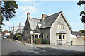
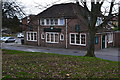
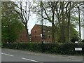

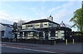

66 photos from this area
Area Information
Key information about the SO19 2NU including its size, population, and administrative classification.
- Area Type
- Postcode
- Area Size
- 1.5 hectares
- Population
- 1805
- Population Density
- 7235 people/km²
House Prices in SO19 2NU
40
Properties
£198,041
Average Sold Price
£85,000
Lowest Price
£340,000
Highest Price
Showing 40 properties
| Address | Type | Beds | Baths | Last Sale Price | Last Sale Date | |
|---|---|---|---|---|---|---|
| 113 Spring Road, Southampton, SO19 2NU | Semi-detached | 3 | 1 | £310,000 | May 2025 | |
| 173 Spring Road, Southampton, SO19 2NU | Semi-detached | 3 | 1 | £340,000 | Dec 2024 | |
| 161 Spring Road, Southampton, SO19 2NU | Retail | 3 | 1 | £290,000 | Dec 2022 | |
| 111 Spring Road, Southampton, SO19 2NU | house | - | - | £340,000 | Jul 2022 | |
| 139 Spring Road, Southampton, SO19 2NU | Semi-detached | 3 | - | £242,000 | Sep 2019 | |
| 163 Spring Road, Southampton, SO19 2NU | house | - | - | £186,000 | Nov 2013 | |
| 143C Spring Road, Southampton, SO19 2NU | Semi-detached | 2 | 2 | £154,500 | Jan 2012 | |
| 169 Spring Road, Southampton, SO19 2NU | Bungalow | 2 | - | £120,000 | Nov 2011 | |
| 115 Spring Road, Southampton, SO19 2NU | Detached | 3 | 2 | £198,500 | Feb 2008 | |
| 165 Spring Road, Southampton, SO19 2NU | Semi-detached | - | - | £198,000 | Sep 2007 |
Page 1 of 4
Energy Efficiency in SO19 2NU
Amenities
Schools
| Rank | School | Type | Entry gender | Ages |
|---|
Explore more schools in this area
Go to Schools tabDemographics
Household Size
One person
most common
Accommodation Type
Houses
most common
Tenure
51
majority
Ethnic Group
White
most common
Religion
N/A
most common
Household Composition
N/A
most common
Age
47
median
Adults (30-64 years)
most common
Household Deprivation
N/A
with no deprivation
NS-SEC
28
in Lower managerial occupations
Explore more demographic insights in this area
Go to Demographics tabPlanning
Planning Constraints
- Flood RiskPremium
- Ramsar Wetland SitesPremium
- Area of Outstanding Natural BeautyPremium
- Protected Nature ReservePremium
- Protected WoodlandPremium