Area Overview for SO19 2EJ
Photos of SO19 2EJ

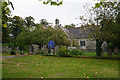
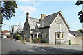
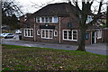
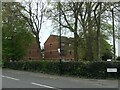

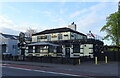

66 photos from this area
Area Information
Key information about the SO19 2EJ including its size, population, and administrative classification.
- Area Type
- Postcode
- Area Size
- 7409 m²
- Population
- 1342
- Population Density
- 6164 people/km²
House Prices in SO19 2EJ
17
Properties
£169,361
Average Sold Price
£49,750
Lowest Price
£300,000
Highest Price
Showing 17 properties
| Address | Type | Beds | Baths | Last Sale Price | Last Sale Date | |
|---|---|---|---|---|---|---|
| 146 Sholing Road, Southampton, SO19 2EJ | Semi-detached | 3 | 1 | £300,000 | Apr 2025 | |
| 136 Sholing Road, Southampton, SO19 2EJ | Semi-detached | 3 | 1 | £300,000 | Jan 2025 | |
| 132 Sholing Road, Southampton, SO19 2EJ | house | - | - | £225,000 | Mar 2020 | |
| 124 Sholing Road, Southampton, SO19 2EJ | Semi-detached | 3 | 1 | £216,000 | Jan 2016 | |
| 126 Sholing Road, Southampton, SO19 2EJ | Semi-detached | - | - | £145,000 | Sep 2011 | |
| 144 Sholing Road, Southampton, SO19 2EJ | Semi-detached | 3 | 1 | £179,000 | Nov 2006 | |
| 142 Sholing Road, Southampton, SO19 2EJ | Semi-detached | 2 | 2 | £54,500 | Jun 1997 | |
| 154 Sholing Road, Southampton, SO19 2EJ | Semi-detached | - | - | £55,000 | Oct 1996 | |
| 134 Sholing Road, Southampton, SO19 2EJ | Semi-detached | - | - | £49,750 | Aug 1995 | |
| 128 Sholing Road, Southampton, SO19 2EJ | Semi-detached | - | - | - | - |
Page 1 of 2
Energy Efficiency in SO19 2EJ
Amenities
Schools
| Rank | School | Type | Entry gender | Ages |
|---|
Explore more schools in this area
Go to Schools tabDemographics
Household Size
Family (3-5 people)
most common
Accommodation Type
Houses
most common
Tenure
55
majority
Ethnic Group
White
most common
Religion
N/A
most common
Household Composition
N/A
most common
Age
47
median
Adults (30-64 years)
most common
Household Deprivation
N/A
with no deprivation
NS-SEC
21
in Lower managerial occupations
Explore more demographic insights in this area
Go to Demographics tabPlanning
Planning Constraints
- Flood RiskPremium
- Ramsar Wetland SitesPremium
- Area of Outstanding Natural BeautyPremium
- Protected Nature ReservePremium
- Protected WoodlandPremium