Area Overview for SO19 2FZ
Photos of SO19 2FZ

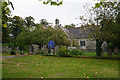
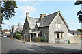
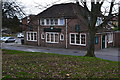
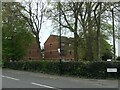
66 photos from this area
Area Information
Key information about the SO19 2FZ including its size, population, and administrative classification.
- Area Type
- Postcode
- Area Size
- 6488 m²
- Population
- 1463
- Population Density
- 7047 people/km²
House Prices in SO19 2FZ
26
Properties
£170,681
Average Sold Price
£51,500
Lowest Price
£290,000
Highest Price
Showing 26 properties
| Address | Type | Beds | Baths | Last Sale Price | Last Sale Date | |
|---|---|---|---|---|---|---|
| 4 Millais Road, Southampton, SO19 2FZ | Semi-detached | 3 | 2 | £290,000 | May 2023 | |
| 6 Millais Road, Southampton, SO19 2FZ | Semi-detached | 3 | 1 | £245,000 | Aug 2019 | |
| 52 Millais Road, Southampton, SO19 2FZ | Semi-detached | 3 | 2 | £230,000 | Nov 2018 | |
| 10 Millais Road, Southampton, SO19 2FZ | Semi-detached | 3 | 2 | £211,000 | Aug 2018 | |
| 18 Millais Road, Southampton, SO19 2FZ | Semi-detached | 3 | 1 | £250,000 | Nov 2017 | |
| 32 Millais Road, Southampton, SO19 2FZ | Semi-detached | 4 | 1 | £187,500 | Feb 2015 | |
| 20 Millais Road, Southampton, SO19 2FZ | Semi-detached | 3 | - | £161,000 | Jul 2014 | |
| 40 Millais Road, Southampton, SO19 2FZ | house | 3 | - | £187,000 | Nov 2013 | |
| 44 Millais Road, Southampton, SO19 2FZ | house | 3 | - | £165,000 | Jul 2011 | |
| 36 Millais Road, Southampton, SO19 2FZ | house | - | - | £135,250 | Aug 2010 |
Page 1 of 3
Energy Efficiency in SO19 2FZ
Amenities
Schools
| Rank | School | Type | Entry gender | Ages |
|---|
Explore more schools in this area
Go to Schools tabDemographics
Household Size
Family (3-5 people)
most common
Accommodation Type
Houses
most common
Tenure
70
majority
Ethnic Group
White
most common
Religion
N/A
most common
Household Composition
N/A
most common
Age
47
median
Adults (30-64 years)
most common
Household Deprivation
N/A
with no deprivation
NS-SEC
30
in Lower managerial occupations
Explore more demographic insights in this area
Go to Demographics tabPlanning
Planning Constraints
- Flood RiskPremium
- Ramsar Wetland SitesPremium
- Area of Outstanding Natural BeautyPremium
- Protected Nature ReservePremium
- Protected WoodlandPremium