Area Overview for SO19 0JL
Photos of SO19 0JL
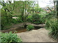
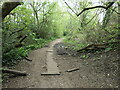
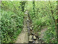
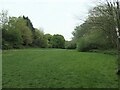
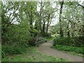
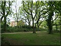
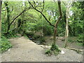
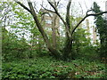
29 photos from this area
Area Information
Key information about the SO19 0JL including its size, population, and administrative classification.
- Area Type
- Postcode
- Area Size
- 6729 m²
- Population
- 1597
- Population Density
- 5557 people/km²
House Prices in SO19 0JL
12
Properties
£191,714
Average Sold Price
£130,000
Lowest Price
£270,000
Highest Price
Showing 12 properties
| Address | Type | Beds | Baths | Last Sale Price | Last Sale Date | |
|---|---|---|---|---|---|---|
| 76 Sullivan Road, Southampton, SO19 0JL | Semi-detached | 3 | 1 | £266,000 | Jul 2023 | |
| 78 Sullivan Road, Southampton, SO19 0JL | Semi-detached | 3 | 1 | £270,000 | Feb 2023 | |
| 82 Sullivan Road, Southampton, SO19 0JL | Semi-detached | 3 | 1 | £176,000 | Feb 2018 | |
| 84 Sullivan Road, Southampton, SO19 0JL | Semi-detached | 3 | 2 | £185,000 | Nov 2017 | |
| 88 Sullivan Road, Southampton, SO19 0JL | Semi-detached | 3 | 2 | £182,000 | May 2016 | |
| 68 Sullivan Road, Southampton, SO19 0JL | Semi-detached | - | - | £130,000 | May 2014 | |
| 72 Sullivan Road, Southampton, SO19 0JL | house | - | - | £133,000 | Sep 2010 | |
| 80 Sullivan Road, Southampton, SO19 0JL | Semi-detached | - | - | - | - | |
| 74 Sullivan Road, Southampton, SO19 0JL | Semi-detached | - | - | - | - | |
| 70 Sullivan Road, Southampton, SO19 0JL | house | - | - | - | - |
Page 1 of 2
Energy Efficiency in SO19 0JL
Amenities
Schools
| Rank | School | Type | Entry gender | Ages |
|---|
Explore more schools in this area
Go to Schools tabDemographics
Household Size
Family (3-5 people)
most common
Accommodation Type
Houses
most common
Tenure
57
majority
Ethnic Group
White
most common
Religion
N/A
most common
Household Composition
N/A
most common
Age
47
median
Adults (30-64 years)
most common
Household Deprivation
N/A
with no deprivation
NS-SEC
23
in Lower managerial occupations
Explore more demographic insights in this area
Go to Demographics tabPlanning
Planning Constraints
- Flood RiskPremium
- Ramsar Wetland SitesPremium
- Area of Outstanding Natural BeautyPremium
- Protected Nature ReservePremium
- Protected WoodlandPremium