Area Overview for SO18 5TF
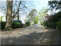
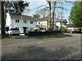
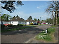
Photos of SO18 5TF
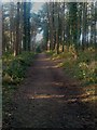


![Thornhill Park Road [A334] in SO18 5TF](https://images.propbar.co.uk/images/geograph/71/75/7175833_120.jpg)
28 photos from this area
Area Information
Key information about the SO18 5TF including its size, population, and administrative classification.
- Area Type
- Postcode
- Area Size
- 1523 m²
- Population
- 1550
- Population Density
- 6861 people/km²
House Prices in SO18 5TF
5
Properties
£195,000
Average Sold Price
£150,000
Lowest Price
£255,000
Highest Price
Showing 5 properties
| Address | Type | Beds | Baths | Last Sale Price | Last Sale Date | |
|---|---|---|---|---|---|---|
| 134 Thornhill Park Road, Southampton, SO18 5TF | Detached | 3 | 1 | £255,000 | Jun 2021 | |
| 130 Thornhill Park Road, Southampton, SO18 5TF | house | 3 | - | £150,000 | Apr 2014 | |
| 128 Thornhill Park Road, Southampton, SO18 5TF | Semi-detached | 3 | - | £195,000 | Dec 2013 | |
| 132 Thornhill Park Road, Southampton, SO18 5TF | house | - | - | £180,000 | Nov 2007 | |
| 136 Thornhill Park Road, Southampton, SO18 5TF | Semi-detached | - | - | - | - |
Energy Efficiency in SO18 5TF
Amenities
Schools
| Rank | School | Type | Entry gender | Ages |
|---|
Explore more schools in this area
Go to Schools tabDemographics
Household Size
Family (3-5 people)
most common
Accommodation Type
Houses
most common
Tenure
52
majority
Ethnic Group
White
most common
Religion
N/A
most common
Household Composition
N/A
most common
Age
47
median
Adults (30-64 years)
most common
Household Deprivation
N/A
with no deprivation
NS-SEC
18
in Lower managerial occupations
Explore more demographic insights in this area
Go to Demographics tabPlanning
Planning Constraints
- Flood RiskPremium
- Ramsar Wetland SitesPremium
- Area of Outstanding Natural BeautyPremium
- Protected Nature ReservePremium
- Protected WoodlandPremium